Trüllikon geodata
Trüllikon (Zurich) is a populated place; located in Switzerland in Europe/Zurich (GMT+2) time zone. With population of 572 people, there are 1724 cities with bigger population in this country. Compared to other cities in Switzerland, 98.1% of cities are located further ↓South; 73.3% of cities are located further ←West and 86.6% of cities have higher elevation than Trüllikon. Note1


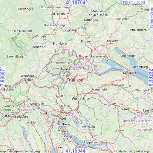
Trüllikon GPS coordinates[2]
47° 38' 7.404" North, 8° 41' 21.084" East
| Map corner | latitude | longitude |
|---|---|---|
| Upper-left | 48.10704°, | 7.98607° |
| Center: | 47.63539°, | 8.68919° |
| Lower-right: | 47.15944°, | 9.39232° |
| Map W x H: | 105.4×105.4 km | = 65.5×65.5mi |
| max Lat: | 47.76737° ⇑1.9% North |
| Trüllikon: | 47.63539° |
| min Lat: | ⇓98.1% South 45.83203° |
| min Long | Trüllikon | max Long |
| 5.97153° | 8.68919° | 10.44624° |
| W 73.3%⇐ | ⇒26.7% E |
Elevation
Elevation of Trüllikon is 406 m = 1332 ft, and this is 152.2 m = 499 ft below average elevation for this country.
| Max E: |
1845 m = 6053 ft | 86.6% |
| Avg. | 558.2 m = 1831 ft | |
| Trüllikon | 406 m = 1332 ft | |
Min E: |
197 m = 646 ft | 13.4% |
See also: Switzerland elevation on elevation.city.
Geographical zone
Trüllikon is located in North temperate zone (between Tropic of Cancer and the Arctic Circle). Distance of this North polar circle is 2104.6 km =1307.7 mi to North.| Distance of | km | miles | from Trüllikon |
|---|---|---|---|
| North Pole | 4710.5 | 2927 | to North |
| Arctic Circle | 2104.6 | 1307.7 | to North |
| Tropic Cancer | 2690.6 | 1671.9 | to South |
| Equator | 5296.6 | 3291.2 | to South |


Nearby cities:
15 places around Trüllikon: (largest is in red/bold)
• Andelfingen
4.6 km =2.9 mi,  190°
190°
• Benken
3.3 km =2.1 mi,  306°
306°
• Dachsen
6.3 km =3.9 mi,  301°
301°
• Diessenhofen
7.5 km =4.7 mi,  37°
37°
• Feuerthalen
7 km =4.3 mi,  330°
330°
• Flurlingen
7 km =4.3 mi,  320°
320°
• Kleinandelfingen
3.9 km =2.4 mi, 186°
• Langwiesen
5.8 km =3.6 mi,  338°
338°
• Marthalen
2.8 km =1.7 mi,  255°
255°
• Marthalen / Dorfkern
3.2 km =2 mi,  250°
250°
• Neu-Rheinau
6 km =3.7 mi,  268°
268°
• Oberneuforn
6.8 km =4.2 mi,  120°
120°
• Ossingen
3.9 km =2.4 mi,  132°
132°
• Uhwiesen
5.6 km =3.5 mi, 314°
• Unterstammheim
7.6 km =4.7 mi,  86°
86°
Sources, notices
• [Note1] Compared only with cities in Switzerland existing in our database
• [Src1] Map data: © OpenStreetMap contributors (CC-BY-SA)
• [Src2] Other city data from geonames.org with taken over terms of usage.
• [Src3] Geographical zone / Annual Mean Temperature by Robert A. Rohde @ Wikipedia
