Zumikon / Fröschgüllen geodata
Zumikon / Fröschgüllen (Zurich) is a section of populated place; located in Switzerland in Europe/Zurich (GMT+2) time zone. With population of 526 people, there are 1769 cities with bigger population in this country. Compared to other cities in Switzerland, 63.1% of cities are located further ↓South; 67.7% of cities are located further ←West and 78% of cities have lower elevation than Zumikon / Fröschgüllen. Note1
Current local time in Zumikon / Fröschgüllen:
07:40 AM, SaturdayDifference from your time zone: hours


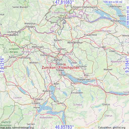
Zumikon / Fröschgüllen GPS coordinates[2]
47° 20' 11.328" North, 8° 36' 55.008" East
| Map corner | latitude | longitude |
|---|---|---|
| Upper-left | 47.81083°, | 7.91216° |
| Center: | 47.33648°, | 8.61528° |
| Lower-right: | 46.85783°, | 9.31841° |
| Map W x H: | 106×106 km | = 65.9×65.9mi |
| max Lat: | 47.76737° ⇑36.9% North |
| Zumikon / Fröschgüllen: | 47.33648° |
| min Lat: | ⇓63.1% South 45.83203° |
| min Long | Zumikon / Frös | max Long |
| 5.97153° | 8.61528° | 10.44624° |
| W 67.7%⇐ | ⇒32.3% E |
Elevation
Elevation of Zumikon / Fröschgüllen is 641 m = 2103 ft, and this is 82.8 m = 272 ft above average elevation for this country.
| Max E: |
1845 m = 6053 ft | 22% |
| Zumikon / Fröschgüllen | 641 m 2103 ft | |
| Avg. | 558.2 m = 1831 ft | |
Min E: |
197 m = 646 ft | 78% |
See also: Switzerland elevation on elevation.city.
Geographical zone
Zumikon / Fröschgüllen is located in North temperate zone (between Tropic of Cancer and the Arctic Circle). Distance of this North polar circle is 2137.9 km =1328.4 mi to North.| Distance of | km | miles | from Zumikon / Fröschgüllen |
|---|---|---|---|
| North Pole | 4743.7 | 2947.6 | to North |
| Arctic Circle | 2137.9 | 1328.4 | to North |
| Tropic Cancer | 2657.4 | 1651.2 | to South |
| Equator | 5263.3 | 3270.5 | to South |


Nearby cities:
15 places around Zumikon / Fröschgüllen: (largest is in red/bold)
• Aesch
3 km =1.9 mi,  104°
104°
• Binz
2.4 km =1.5 mi,  21°
21°
• Ebmatingen
2.4 km =1.5 mi,  51°
51°
• Ebmatingen / Bachtobel
2.6 km =1.6 mi, 47°
• Ebmatingen / Lebern
2.4 km =1.5 mi,  56°
56°
• Küsnacht
3.1 km =1.9 mi,  228°
228°
• Küsnacht / Allmend
2.8 km =1.7 mi,  209°
209°
• Küsnacht / Goldbach
2.8 km =1.7 mi,  248°
248°
• Küsnacht / Itschnach
1.5 km =0.9 mi, 226°
• Küsnacht / Schiedhalden
2.6 km =1.6 mi, 229°
• Rebwies
2.5 km =1.6 mi,  298°
298°
• Zollikerberg
1.4 km =0.9 mi,  311°
311°
• Zollikon
3.1 km =1.9 mi,  277°
277°
• Zumikon
0.8 km =0.5 mi,  134°
134°
• Zürich (Kreis 7) / Witikon
3 km =1.9 mi,  322°
322°
Sources, notices
• [Note1] Compared only with cities in Switzerland existing in our database
• [Src1] Map data: © OpenStreetMap contributors (CC-BY-SA)
• [Src2] Other city data from geonames.org with taken over terms of usage.
• [Src3] Geographical zone / Annual Mean Temperature by Robert A. Rohde @ Wikipedia
