Rikon / Rikon (Dorfkern) geodata
Rikon / Rikon (Dorfkern) (Zurich) is a section of populated place; located in Switzerland in Europe/Zurich (GMT+2) time zone. With population of 850 people, there are 1455 cities with bigger population in this country. Compared to other cities in Switzerland, 81.6% of cities are located further ↓South; 81.1% of cities are located further ←West and 59.5% of cities have lower elevation than Rikon / Rikon (Dorfkern). Note1
Current local time in Rikon / Rikon (Dorfkern):
06:22 AM, SaturdayDifference from your time zone: hours


Rikon / Rikon (Dorfkern) GPS coordinates[2]
47° 26' 45.06" North, 8° 47' 52.656" East
| Map corner | latitude | longitude |
|---|---|---|
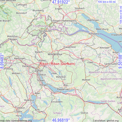
| Upper-left | 47.91922°, | 8.09483° |
| Center: | 47.44585°, | 8.79796° |
| Lower-right: | 46.96819°, | 9.50108° |
| Map W x H: | 105.7×105.7 km | = 65.7×65.7mi |
| max Lat: | 47.76737° ⇑18.4% North |
| Rikon / Rikon (Dorfkern): | 47.44585° |
| min Lat: | ⇓81.6% South 45.83203° |
| min Long | Rikon / Rikon ( | max Long |
| 5.97153° | 8.79796° | 10.44624° |
| W 81.1%⇐ | ⇒18.9% E |
Elevation
Elevation of Rikon / Rikon (Dorfkern) is 516 m = 1693 ft, and this is 42.2 m = 138 ft below average elevation for this country.
| Max E: |
1845 m = 6053 ft | 40.5% |
| Avg. | 558.2 m = 1831 ft | |
| Rikon / Rikon (Dorfkern) | 516 m = 1693 ft | |
Min E: |
197 m = 646 ft | 59.5% |
See also: Switzerland elevation on elevation.city.
Geographical zone
Rikon / Rikon (Dorfkern) is located in North temperate zone (between Tropic of Cancer and the Arctic Circle). Distance of this North polar circle is 2125.7 km =1320.8 mi to North.| Distance of | km | miles | from Rikon / Rikon (Dorfkern) |
|---|---|---|---|
| North Pole | 4731.6 | 2940.1 | to North |
| Arctic Circle | 2125.7 | 1320.8 | to North |
| Tropic Cancer | 2669.6 | 1658.8 | to South |
| Equator | 5275.5 | 3278 | to South |


Nearby cities:
15 places around Rikon / Rikon (Dorfkern): (largest is in red/bold)
• Kollbrunn
1.8 km =1.1 mi,  319°
319°
• Kollbrunn / Kollbrunn (Dorfkern)
2.2 km =1.4 mi,  305°
305°
• Rämismühle
1.9 km =1.2 mi,  112°
112°
• Seen (Kreis 3)
4 km =2.5 mi,  328°
328°
• Seen (Kreis 3) / Büelwiesen
5 km =3.1 mi, 330°
• Seen (Kreis 3) / Ganzenbühl
4.7 km =2.9 mi, 325°
• Seen (Kreis 3) / Iberg
2.6 km =1.6 mi, 324°
• Seen (Kreis 3) / Oberseen
4.4 km =2.7 mi, 334°
• Seen (Kreis 3) / Sennhof
3.9 km =2.4 mi, 309°
• Seen (Kreis 3) / Sonnenberg
5.3 km =3.3 mi,  336°
336°
• Seen (Kreis 3) / Waldegg
5.3 km =3.3 mi, 323°
• Seen (Kreis 3) / Waser
5.6 km =3.5 mi, 329°
• Turbenthal
3.8 km =2.4 mi, 106°
• Weisslingen
2.8 km =1.7 mi,  233°
233°
• Wila
4.6 km =2.9 mi,  129°
129°
Sources, notices
• [Note1] Compared only with cities in Switzerland existing in our database
• [Src1] Map data: © OpenStreetMap contributors (CC-BY-SA)
• [Src2] Other city data from geonames.org with taken over terms of usage.
• [Src3] Geographical zone / Annual Mean Temperature by Robert A. Rohde @ Wikipedia
