Pitrufquén geodata
Pitrufquén (Araucanía) is a populated place; located in Chile in America/Santiago (GMT-4) time zone. With population of 13,743 people, there are 99 cities with bigger population in this country. Compared to other cities in Chile, 73.1% of cities are located further ↑North; 73.1% of cities are located further →East and 60% of cities have higher elevation than Pitrufquén. Note1


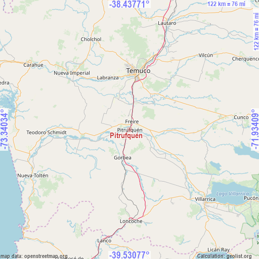
Pitrufquén GPS coordinates[2]
38° 59' 10.86" South, 72° 38' 13.956" West
| Map corner | latitude | longitude |
|---|---|---|
| Upper-left | -38.43771°, | -73.34034° |
| Center: | -38.98635°, | -72.63721° |
| Lower-right: | -39.53077°, | -71.93409° |
| Map W x H: | 121.5×121.5 km | = 75.5×75.5mi |
| max Lat: | -18.19821° ⇑73.1% North |
| Pitrufquén: | -38.98635° |
| min Lat: | ⇓26.9% South -54.93355° |
| min Long | Pitrufquén | max Long |
| -109.42438° | -72.63721° | -67.60963° |
| W 26.9%⇐ | ⇒73.1% E |
Elevation
Elevation of Pitrufquén is 99 m = 325 ft, and this is 174 m = 571 ft below average elevation for this country.
| Max E: |
3544 m = 11627 ft | 60% |
| Avg. | 273 m = 896 ft | |
| Pitrufquén | 99 m = 325 ft | |
Min E: |
1 m = 3 ft | 40% |
See also: Chile elevation on elevation.city.
Geographical zone
Pitrufquén is located in South temperate zone (between Tropic of Capricorn and the Antarctic Circle). Distance of this Southern Tropic circle is 1729 km =1074.4 mi to North.| Distance of | km | miles | from Pitrufquén |
|---|---|---|---|
| Equator | 4334.9 | 2693.6 | to North |
| Tropic Capricorn | 1729 | 1074.4 | to North |
| Antarctic Circle | 3066.3 | 1905.3 | to South |
| South Pole | 5672.2 | 3524.5 | to South |


Nearby cities:
15 places around Pitrufquén: (largest is in red/bold)
• Carahue
54.7 km =34 mi,  303°
303°
• Freire
3.9 km =2.4 mi,  13°
13°
• Las Animas
104.2 km =64.7 mi,  208°
208°
• Lautaro
53.6 km =33.3 mi,  18°
18°
• Loncoche
42.3 km =26.3 mi,  179°
179°
• Nueva Imperial
38.2 km =23.7 mi,  314°
314°
• Panguipulli
77.6 km =48.2 mi,  160°
160°
• Pucón
67.5 km =41.9 mi,  119°
119°
• Temuco
27.6 km =17.1 mi, 6°
• Traiguén
82 km =51 mi,  357°
357°
• Valdivia
105.9 km =65.8 mi, 209°
• Victoria
87.8 km =54.6 mi, 17°
• Vilcún
50.2 km =31.2 mi,  45°
45°
• Villa Europa
107.8 km =67 mi, 208°
• Villarrica
48.5 km =30.1 mi,  133°
133°
Sources, notices
• [Note1] Compared only with cities in Chile existing in our database
• [Src1] Map data: © OpenStreetMap contributors (CC-BY-SA)
• [Src2] Other city data from geonames.org with taken over terms of usage.
• [Src3] Geographical zone / Annual Mean Temperature by Robert A. Rohde @ Wikipedia
