Traiguén geodata
Traiguén (Araucanía) is a populated place; located in Chile in America/Santiago (GMT-4) time zone. With population of 14,481 people, there are 97 cities with bigger population in this country. Compared to other cities in Chile, 68.3% of cities are located further ↑North; 73.8% of cities are located further →East and 57.9% of cities have lower elevation than Traiguén. Note1


Traiguén GPS coordinates[2]
38° 14' 58.56" South, 72° 40' 12.972" West
| Map corner | latitude | longitude |
|---|---|---|
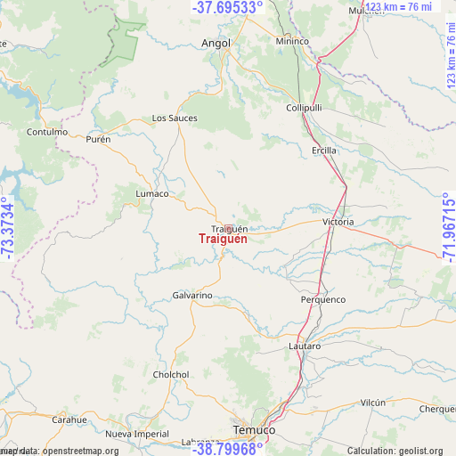
| Upper-left | -37.69533°, | -73.3734° |
| Center: | -38.2496°, | -72.67027° |
| Lower-right: | -38.79968°, | -71.96715° |
| Map W x H: | 122.8×122.8 km | = 76.3×76.3mi |
| max Lat: | -18.19821° ⇑68.3% North |
| Traiguén: | -38.2496° |
| min Lat: | ⇓31.7% South -54.93355° |
| min Long | Traiguén | max Long |
| -109.42438° | -72.67027° | -67.60963° |
| W 26.2%⇐ | ⇒73.8% E |
Elevation
Elevation of Traiguén is 180 m = 591 ft, and this is 93 m = 305 ft below average elevation for this country.
| Max E: |
3544 m = 11627 ft | 42.1% |
| Avg. | 273 m = 896 ft | |
| Traiguén | 180 m = 591 ft | |
Min E: |
1 m = 3 ft | 57.9% |
See also: Chile elevation on elevation.city.
Geographical zone
Traiguén is located in South temperate zone (between Tropic of Capricorn and the Antarctic Circle). Distance of this Southern Tropic circle is 1647 km =1023.4 mi to North.| Distance of | km | miles | from Traiguén |
|---|---|---|---|
| Equator | 4253 | 2642.7 | to North |
| Tropic Capricorn | 1647 | 1023.4 | to North |
| Antarctic Circle | 3148.2 | 1956.2 | to South |
| South Pole | 5754.1 | 3575.4 | to South |


Nearby cities:
15 places around Traiguén: (largest is in red/bold)
• Angol
50.7 km =31.5 mi,  355°
355°
• Carahue
66.8 km =41.5 mi,  219°
219°
• Cañete
80.8 km =50.2 mi,  308°
308°
• Collipulli
38.8 km =24.1 mi,  32°
32°
• Curanilahue
104.3 km =64.8 mi,  325°
325°
• Freire
78.2 km =48.6 mi,  177°
177°
• Lautaro
37.3 km =23.2 mi,  146°
146°
• Los Ángeles
91.1 km =56.6 mi,  17°
17°
• Mulchén
70 km =43.5 mi, 32°
• Nacimiento
83.1 km =51.6 mi, 359°
• Nueva Imperial
60.2 km =37.4 mi,  203°
203°
• Pitrufquén
82 km =51 mi, 177°
• Temuco
54.8 km =34.1 mi,  173°
173°
• Victoria
29.5 km =18.3 mi,  86°
86°
• Vilcún
60.6 km =37.7 mi,  140°
140°
Sources, notices
• [Note1] Compared only with cities in Chile existing in our database
• [Src1] Map data: © OpenStreetMap contributors (CC-BY-SA)
• [Src2] Other city data from geonames.org with taken over terms of usage.
• [Src3] Geographical zone / Annual Mean Temperature by Robert A. Rohde @ Wikipedia
