Corral geodata
Corral (Los Ríos Region) is a populated place; located in Chile in America/Santiago (GMT-4) time zone. With population of 3,500 people, there are 121 cities with bigger population in this country. Compared to other cities in Chile, 79.3% of cities are located further ↑North; 95.2% of cities are located further →East and 99.3% of cities have higher elevation than Corral. Note1


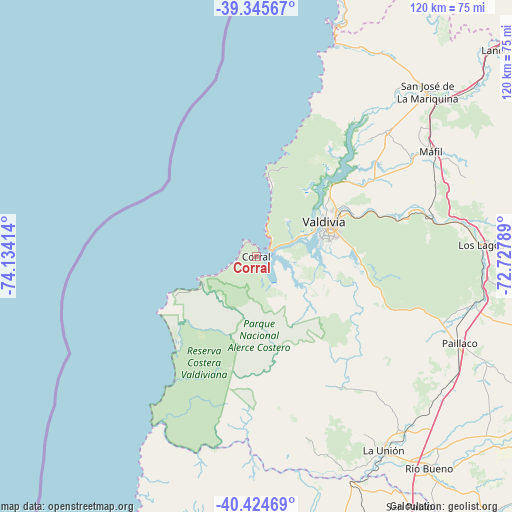
Corral GPS coordinates[2]
39° 53' 14.28" South, 73° 25' 51.636" West
| Map corner | latitude | longitude |
|---|---|---|
| Upper-left | -39.34567°, | -74.13414° |
| Center: | -39.8873°, | -73.43101° |
| Lower-right: | -40.42469°, | -72.72789° |
| Map W x H: | 120×120 km | = 74.6×74.6mi |
| max Lat: | -18.19821° ⇑79.3% North |
| Corral: | -39.8873° |
| min Lat: | ⇓20.7% South -54.93355° |
| min Long | Corral | max Long |
| -109.42438° | -73.43101° | -67.60963° |
| W 4.8%⇐ | ⇒95.2% E |
Elevation
Elevation of Corral is 5 m = 16 ft, and this is 268 m = 879 ft below average elevation for this country.
| Max E: |
3544 m = 11627 ft | 99.3% |
| Avg. | 273 m = 896 ft | |
| Corral | 5 m = 16 ft | |
Min E: |
1 m = 3 ft | 0.7% |
See also: Chile elevation on elevation.city.
Geographical zone
Corral is located in South temperate zone (between Tropic of Capricorn and the Antarctic Circle). Distance of this Southern Tropic circle is 1829.1 km =1136.5 mi to North.| Distance of | km | miles | from Corral |
|---|---|---|---|
| Equator | 4435.1 | 2755.8 | to North |
| Tropic Capricorn | 1829.1 | 1136.5 | to North |
| Antarctic Circle | 2966.1 | 1843 | to South |
| South Pole | 5572 | 3462.3 | to South |


Nearby cities:
15 places around Corral: (largest is in red/bold)
• Freire
124.8 km =77.5 mi,  33°
33°
• La Unión
54 km =33.6 mi,  146°
146°
• Las Animas
20.2 km =12.6 mi,  64°
64°
• Las Gaviotas
20.8 km =12.9 mi,  83°
83°
• Loncoche
89.7 km =55.7 mi,  49°
49°
• Osorno
80.4 km =50 mi,  161°
161°
• Panguipulli
97.7 km =60.7 mi,  73°
73°
• Pitrufquén
121.2 km =75.3 mi, 34°
• Purranque
116.4 km =72.3 mi,  168°
168°
• Puyehue
111 km =69 mi,  140°
140°
• Río Bueno
64.1 km =39.8 mi, 140°
• Santa Rosa
80.8 km =50.2 mi,  113°
113°
• Valdivia
17.8 km =11.1 mi, 62°
• Villa Europa
17.5 km =10.9 mi, 72°
• Villarrica
122.9 km =76.4 mi, 57°
Sources, notices
• [Note1] Compared only with cities in Chile existing in our database
• [Src1] Map data: © OpenStreetMap contributors (CC-BY-SA)
• [Src2] Other city data from geonames.org with taken over terms of usage.
• [Src3] Geographical zone / Annual Mean Temperature by Robert A. Rohde @ Wikipedia
