Zhouwang geodata
Zhouwang (Hunan) is a seat of a fourth-order administrative division; located in China in Asia/Shanghai (GMT+8) time zone. In our database, there are 1268 cities with bigger population. Compared to other cities in China, 77.8% of cities are located further ↑North; 66.3% of cities are located further →East and 66.8% of cities have lower elevation than Zhouwang. Note1


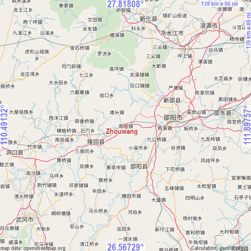
Zhouwang GPS coordinates[2]
27° 11' 39.984" North, 111° 11' 39.984" East
| Map corner | latitude | longitude |
|---|---|---|
| Upper-left | 27.81808°, | 110.49132° |
| Center: | 27.19444°, | 111.19444° |
| Lower-right: | 26.56729°, | 111.89757° |
| Map W x H: | 139.1×139.1 km | = 86.4×86.4mi |
| max Lat: | 53.31946° ⇑77.8% North |
| Zhouwang: | 27.19444° |
| min Lat: | ⇓22.2% South 18.22056° |
| min Long | Zhouwang | max Long |
| 75.07348° | 111.19444° | 134.28917° |
| W 33.7%⇐ | ⇒66.3% E |
Elevation
Elevation of Zhouwang is 356 m = 1168 ft, and this is 128.8 m = 423 ft below average elevation for this country.
| Max E: |
5622 m = 18445 ft | 33.2% |
| Avg. | 484.8 m = 1591 ft | |
| Zhouwang | 356 m = 1168 ft | |
Min E: |
-3 m = -10 ft | 66.8% |
See also: China elevation on elevation.city.
Geographical zone
Zhouwang is located in North temperate zone (between Tropic of Cancer and the Arctic Circle). Distance of this Northern Tropic circle is 417.8 km =259.6 mi to South.| Distance of | km | miles | from Zhouwang |
|---|---|---|---|
| North Pole | 6983.3 | 4339.2 | to North |
| Arctic Circle | 4377.4 | 2720 | to North |
| Tropic Cancer | 417.8 | 259.6 | to South |
| Equator | 3023.7 | 1878.8 | to South |


Nearby cities:
15 places around Zhouwang: (largest is in red/bold)
• Beishan
16.3 km =10.1 mi,  220°
220°
• Gaoping
32.2 km =20 mi,  350°
350°
• Hengbanqiao
32.7 km =20.3 mi,  265°
265°
• Hetian
27.8 km =17.3 mi,  307°
307°
• Hexiangqiao
23 km =14.3 mi,  277°
277°
• Liuduzhai
32 km =19.9 mi, 306°
• Niangxi
26.7 km =16.6 mi,  61°
61°
• Sangesi
27.7 km =17.2 mi,  239°
239°
• Shanjie
21.7 km =13.5 mi,  233°
233°
• Shimen
16.7 km =10.4 mi, 282°
• Tangdukou
25.8 km =16 mi,  169°
169°
• Tantou
9.2 km =5.7 mi,  327°
327°
• Taohong
22.3 km =13.9 mi, 242°
• Yankou
20.1 km =12.5 mi, 328°
• Yushanpu
9.4 km =5.8 mi, 238°
Sources, notices
• [Note1] Compared only with cities in China existing in our database
• [Src1] Map data: © OpenStreetMap contributors (CC-BY-SA)
• [Src2] Other city data from geonames.org with taken over terms of usage.
• [Src3] Geographical zone / Annual Mean Temperature by Robert A. Rohde @ Wikipedia
