Hexiangqiao geodata
Hexiangqiao (Hunan) is a seat of a fourth-order administrative division; located in China in Asia/Shanghai (GMT+8) time zone. With population of 4,570 people, there are 880 cities with bigger population in this country. Compared to other cities in China, 77.6% of cities are located further ↑North; 67.1% of cities are located further →East and 61.6% of cities have lower elevation than Hexiangqiao. Note1


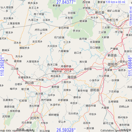
Hexiangqiao GPS coordinates[2]
27° 13' 13.008" North, 110° 57' 47.988" East
| Map corner | latitude | longitude |
|---|---|---|
| Upper-left | 27.84377°, | 110.26021° |
| Center: | 27.22028°, | 110.96333° |
| Lower-right: | 26.59328°, | 111.66646° |
| Map W x H: | 139×139 km | = 86.4×86.4mi |
| max Lat: | 53.31946° ⇑77.6% North |
| Hexiangqiao: | 27.22028° |
| min Lat: | ⇓22.4% South 18.22056° |
| min Long | Hexiangqiao | max Long |
| 75.07348° | 110.96333° | 134.28917° |
| W 32.9%⇐ | ⇒67.1% E |
Elevation
Elevation of Hexiangqiao is 278 m = 912 ft, and this is 206.8 m = 678 ft below average elevation for this country.
| Max E: |
5622 m = 18445 ft | 38.4% |
| Avg. | 484.8 m = 1591 ft | |
| Hexiangqiao | 278 m = 912 ft | |
Min E: |
-3 m = -10 ft | 61.6% |
See also: China elevation on elevation.city.
Geographical zone
Hexiangqiao is located in North temperate zone (between Tropic of Cancer and the Arctic Circle). Distance of this Northern Tropic circle is 420.7 km =261.4 mi to South.| Distance of | km | miles | from Hexiangqiao |
|---|---|---|---|
| North Pole | 6980.5 | 4337.5 | to North |
| Arctic Circle | 4374.6 | 2718.2 | to North |
| Tropic Cancer | 420.7 | 261.4 | to South |
| Equator | 3026.6 | 1880.6 | to South |


Nearby cities:
15 places around Hexiangqiao: (largest is in red/bold)
• Beishan
19.7 km =12.2 mi,  141°
141°
• Hengbanqiao
11.1 km =6.9 mi,  240°
240°
• Hetian
14.1 km =8.8 mi,  3°
3°
• Liuduzhai
16.5 km =10.3 mi,  350°
350°
• Nanyuemiao
15.1 km =9.4 mi,  226°
226°
• Sangesi
17.1 km =10.6 mi,  182°
182°
• Shanjie
16.8 km =10.4 mi,  160°
160°
• Shijiang
22.8 km =14.2 mi, 227°
• Shimen
6.6 km =4.1 mi,  83°
83°
• Tantou
18.5 km =11.5 mi,  74°
74°
• Taohong
13.6 km =8.5 mi,  166°
166°
• Xiyangjiang
13.7 km =8.5 mi,  255°
255°
• Yankou
18.8 km =11.7 mi,  40°
40°
• Yushanpu
16.7 km =10.4 mi,  117°
117°
• Zhouwang
23 km =14.3 mi,  97°
97°
Sources, notices
• [Note1] Compared only with cities in China existing in our database
• [Src1] Map data: © OpenStreetMap contributors (CC-BY-SA)
• [Src2] Other city data from geonames.org with taken over terms of usage.
• [Src3] Geographical zone / Annual Mean Temperature by Robert A. Rohde @ Wikipedia
