Shanjie geodata
Shanjie (Hunan) is a seat of a fourth-order administrative division; located in China in Asia/Shanghai (GMT+8) time zone. In our database, there are 1268 cities with bigger population. Compared to other cities in China, 78.3% of cities are located further ↑North; 66.9% of cities are located further →East and 60.6% of cities have lower elevation than Shanjie. Note1


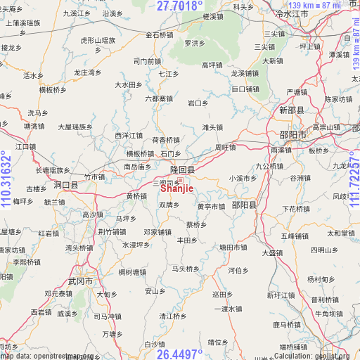
Shanjie GPS coordinates[2]
27° 4' 39" North, 111° 1' 9.984" East
| Map corner | latitude | longitude |
|---|---|---|
| Upper-left | 27.7018°, | 110.31632° |
| Center: | 27.0775°, | 111.01944° |
| Lower-right: | 26.4497°, | 111.72257° |
| Map W x H: | 139.2×139.2 km | = 86.5×86.5mi |
| max Lat: | 53.31946° ⇑78.3% North |
| Shanjie: | 27.0775° |
| min Lat: | ⇓21.7% South 18.22056° |
| min Long | Shanjie | max Long |
| 75.07348° | 111.01944° | 134.28917° |
| W 33.1%⇐ | ⇒66.9% E |
Elevation
Elevation of Shanjie is 267 m = 876 ft, and this is 217.8 m = 715 ft below average elevation for this country.
| Max E: |
5622 m = 18445 ft | 39.4% |
| Avg. | 484.8 m = 1591 ft | |
| Shanjie | 267 m = 876 ft | |
Min E: |
-3 m = -10 ft | 60.6% |
See also: China elevation on elevation.city.
Geographical zone
Shanjie is located in North temperate zone (between Tropic of Cancer and the Arctic Circle). Distance of this Northern Tropic circle is 404.8 km =251.5 mi to South.| Distance of | km | miles | from Shanjie |
|---|---|---|---|
| North Pole | 6996.3 | 4347.3 | to North |
| Arctic Circle | 4390.4 | 2728.1 | to North |
| Tropic Cancer | 404.8 | 251.5 | to South |
| Equator | 3010.7 | 1870.8 | to South |


Nearby cities:
15 places around Shanjie: (largest is in red/bold)
• Beishan
6.8 km =4.2 mi,  85°
85°
• Dengjiapu
21.6 km =13.4 mi,  207°
207°
• Hengbanqiao
18.5 km =11.5 mi,  304°
304°
• Hexiangqiao
16.8 km =10.4 mi,  340°
340°
• Huangqiao
18.8 km =11.7 mi,  250°
250°
• Nanyuemiao
17.5 km =10.9 mi,  288°
288°
• Sangesi
6.5 km =4 mi,  259°
259°
• Shijiang
22.4 km =13.9 mi,  271°
271°
• Shimen
16.6 km =10.3 mi,  3°
3°
• Tangdukou
25.2 km =15.7 mi,  119°
119°
• Tantou
24.1 km =15 mi,  30°
30°
• Taohong
3.6 km =2.2 mi,  317°
317°
• Xiyangjiang
22.6 km =14 mi, 303°
• Yushanpu
12.3 km =7.6 mi,  48°
48°
• Zhouwang
21.7 km =13.5 mi, 53°
Sources, notices
• [Note1] Compared only with cities in China existing in our database
• [Src1] Map data: © OpenStreetMap contributors (CC-BY-SA)
• [Src2] Other city data from geonames.org with taken over terms of usage.
• [Src3] Geographical zone / Annual Mean Temperature by Robert A. Rohde @ Wikipedia
