Niangxi geodata
Niangxi (Hunan) is a seat of a third-order administrative division; located in China in Asia/Shanghai (GMT+8) time zone. In our database, there are 1268 cities with bigger population. Compared to other cities in China, 77.4% of cities are located further ↑North; 65.4% of cities are located further →East and 58.9% of cities have lower elevation than Niangxi. Note1


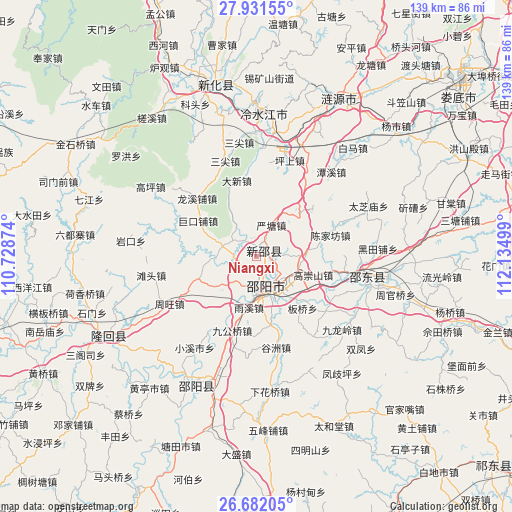
Niangxi GPS coordinates[2]
27° 18' 30.816" North, 111° 25' 54.696" East
| Map corner | latitude | longitude |
|---|---|---|
| Upper-left | 27.93155°, | 110.72874° |
| Center: | 27.30856°, | 111.43186° |
| Lower-right: | 26.68205°, | 112.13499° |
| Map W x H: | 138.9×138.9 km | = 86.3×86.3mi |
| max Lat: | 53.31946° ⇑77.4% North |
| Niangxi: | 27.30856° |
| min Lat: | ⇓22.6% South 18.22056° |
| min Long | Niangxi | max Long |
| 75.07348° | 111.43186° | 134.28917° |
| W 34.6%⇐ | ⇒65.4% E |
Elevation
Elevation of Niangxi is 246 m = 807 ft, and this is 238.8 m = 783 ft below average elevation for this country.
| Max E: |
5622 m = 18445 ft | 41.1% |
| Avg. | 484.8 m = 1591 ft | |
| Niangxi | 246 m = 807 ft | |
Min E: |
-3 m = -10 ft | 58.9% |
See also: China elevation on elevation.city.
Geographical zone
Niangxi is located in North temperate zone (between Tropic of Cancer and the Arctic Circle). Distance of this Northern Tropic circle is 430.5 km =267.5 mi to South.| Distance of | km | miles | from Niangxi |
|---|---|---|---|
| North Pole | 6970.6 | 4331.3 | to North |
| Arctic Circle | 4364.7 | 2712.1 | to North |
| Tropic Cancer | 430.5 | 267.5 | to South |
| Equator | 3036.4 | 1886.7 | to South |


Nearby cities:
15 places around Niangxi: (largest is in red/bold)
• Beishan
42.3 km =26.3 mi,  233°
233°
• Gaoping
34.3 km =21.3 mi,  303°
303°
• Hetian
45.7 km =28.4 mi,  275°
275°
• Hexiangqiao
47.3 km =29.4 mi,  258°
258°
• Lengshuijiang
42.2 km =26.2 mi,  359°
359°
• Liangshi
32.2 km =20 mi,  110°
110°
• Lianyuan
48 km =29.8 mi,  28°
28°
• Luohong
44.6 km =27.7 mi,  307°
307°
• Qijiang
47.9 km =29.8 mi,  289°
289°
• Shimen
40.7 km =25.3 mi, 257°
• Tangdukou
42.5 km =26.4 mi,  206°
206°
• Tantou
28.9 km =18 mi, 260°
• Yankou
34.2 km =21.3 mi, 277°
• Yushanpu
36.1 km =22.4 mi,  240°
240°
• Zhouwang
26.7 km =16.6 mi, 241°
Sources, notices
• [Note1] Compared only with cities in China existing in our database
• [Src1] Map data: © OpenStreetMap contributors (CC-BY-SA)
• [Src2] Other city data from geonames.org with taken over terms of usage.
• [Src3] Geographical zone / Annual Mean Temperature by Robert A. Rohde @ Wikipedia
