Zhongcun geodata
Zhongcun (Yunnan) is a seat of a fourth-order administrative division; located in China in Asia/Shanghai (GMT+8) time zone. In our database, there are 1268 cities with bigger population. Compared to other cities in China, 75.2% of cities are located further ↑North; 94.4% of cities are located further →East and 95% of cities have lower elevation than Zhongcun. Note1


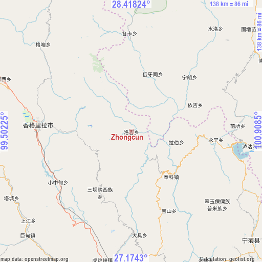
Zhongcun GPS coordinates[2]
27° 47' 52.98" North, 100° 12' 19.332" East
| Map corner | latitude | longitude |
|---|---|---|
| Upper-left | 28.41824°, | 99.50225° |
| Center: | 27.79805°, | 100.20537° |
| Lower-right: | 27.1743°, | 100.9085° |
| Map W x H: | 138.3×138.3 km | = 85.9×85.9mi |
| max Lat: | 53.31946° ⇑75.2% North |
| Zhongcun: | 27.79805° |
| min Lat: | ⇓24.8% South 18.22056° |
| min Long | Zhongcun | max Long |
| 75.07348° | 100.20537° | 134.28917° |
| W 5.6%⇐ | ⇒94.4% E |
Elevation
Elevation of Zhongcun is 2118 m = 6949 ft, and this is 1633.2 m = 5358 ft above average elevation for this country.
| Max E: |
5622 m = 18445 ft | 5% |
| Zhongcun | 2118 m 6949 ft | |
| Avg. | 484.8 m = 1591 ft | |
Min E: |
-3 m = -10 ft | 95% |
See also: China elevation on elevation.city.
Geographical zone
Zhongcun is located in North temperate zone (between Tropic of Cancer and the Arctic Circle). Distance of this Northern Tropic circle is 484.9 km =301.3 mi to South.| Distance of | km | miles | from Zhongcun |
|---|---|---|---|
| North Pole | 6916.2 | 4297.5 | to North |
| Arctic Circle | 4310.3 | 2678.3 | to North |
| Tropic Cancer | 484.9 | 301.3 | to South |
| Equator | 3090.9 | 1920.6 | to South |


Nearby cities:
15 places around Zhongcun: (largest is in red/bold)
• Bengshutang
73.4 km =45.6 mi,  291°
291°
• Benzilan
95.5 km =59.3 mi,  300°
300°
• Daxing
88 km =54.7 mi,  132°
132°
• Dongwang
96.2 km =59.8 mi,  331°
331°
• Geluwan
71.8 km =44.6 mi,  228°
228°
• Gezan
59.6 km =37 mi,  319°
319°
• Jiantang
43 km =26.7 mi,  273°
273°
• Kaiwen
80.2 km =49.8 mi,  207°
207°
• Lazanzhong
66.1 km =41.1 mi, 315°
• Shangri-La
49 km =30.4 mi, 273°
• Shuijia
37.2 km =23.1 mi,  202°
202°
• Tuoding
72.3 km =44.9 mi, 266°
• Wujing
66.6 km =41.4 mi,  260°
260°
• Xiaqiaotou
70 km =43.5 mi,  193°
193°
• Xiaruo
83.4 km =51.8 mi, 270°
Sources, notices
• [Note1] Compared only with cities in China existing in our database
• [Src1] Map data: © OpenStreetMap contributors (CC-BY-SA)
• [Src2] Other city data from geonames.org with taken over terms of usage.
• [Src3] Geographical zone / Annual Mean Temperature by Robert A. Rohde @ Wikipedia
