Kaiwen geodata
Kaiwen (Yunnan) is a seat of a fourth-order administrative division; located in China in Asia/Shanghai (GMT+8) time zone. In our database, there are 1268 cities with bigger population. Compared to other cities in China, 78% of cities are located further ↑North; 94.6% of cities are located further →East and 94.2% of cities have lower elevation than Kaiwen. Note1


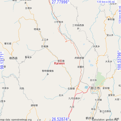
Kaiwen GPS coordinates[2]
27° 9' 21.96" North, 99° 50' 5.388" East
| Map corner | latitude | longitude |
|---|---|---|
| Upper-left | 27.77996°, | 99.13171° |
| Center: | 27.1561°, | 99.83483° |
| Lower-right: | 26.52874°, | 100.53796° |
| Map W x H: | 139.1×139.1 km | = 86.4×86.4mi |
| max Lat: | 53.31946° ⇑78% North |
| Kaiwen: | 27.1561° |
| min Lat: | ⇓22% South 18.22056° |
| min Long | Kaiwen | max Long |
| 75.07348° | 99.83483° | 134.28917° |
| W 5.4%⇐ | ⇒94.6% E |
Elevation
Elevation of Kaiwen is 1891 m = 6204 ft, and this is 1406.2 m = 4614 ft above average elevation for this country.
| Max E: |
5622 m = 18445 ft | 5.8% |
| Kaiwen | 1891 m 6204 ft | |
| Avg. | 484.8 m = 1591 ft | |
Min E: |
-3 m = -10 ft | 94.2% |
See also: China elevation on elevation.city.
Geographical zone
Kaiwen is located in North temperate zone (between Tropic of Cancer and the Arctic Circle). Distance of this Northern Tropic circle is 413.6 km =257 mi to South.| Distance of | km | miles | from Kaiwen |
|---|---|---|---|
| North Pole | 6987.6 | 4341.9 | to North |
| Arctic Circle | 4381.7 | 2722.7 | to North |
| Tropic Cancer | 413.6 | 257 | to South |
| Equator | 3019.5 | 1876.2 | to South |


Nearby cities:
15 places around Kaiwen: (largest is in red/bold)
• Baohe
50.6 km =31.4 mi,  275°
275°
• Geluwan
30 km =18.6 mi,  323°
323°
• Huangshan
52.9 km =32.9 mi,  133°
133°
• Jiantang
74.4 km =46.2 mi,  355°
355°
• Jinhua
69.2 km =43 mi,  173°
173°
• Kangpu
87.4 km =54.3 mi,  304°
304°
• Lijiang
49.8 km =30.9 mi, 129°
• Shangri-La
75.4 km =46.9 mi,  350°
350°
• Shuijia
43.3 km =26.9 mi,  31°
31°
• Tuoding
76 km =47.2 mi,  331°
331°
• Wujing
67.5 km =41.9 mi, 334°
• Xiaqiaotou
20.9 km =13 mi,  81°
81°
• Xiaruo
86.5 km =53.7 mi, 327°
• Yunhe
78.9 km =49 mi,  152°
152°
• Zhongcun
80.2 km =49.8 mi, 27°
Sources, notices
• [Note1] Compared only with cities in China existing in our database
• [Src1] Map data: © OpenStreetMap contributors (CC-BY-SA)
• [Src2] Other city data from geonames.org with taken over terms of usage.
• [Src3] Geographical zone / Annual Mean Temperature by Robert A. Rohde @ Wikipedia
