Wujing geodata
Wujing (Yunnan) is a seat of a fourth-order administrative division; located in China in Asia/Shanghai (GMT+8) time zone. In our database, there are 1268 cities with bigger population. Compared to other cities in China, 75.7% of cities are located further ↑North; 94.8% of cities are located further →East and 98.2% of cities have lower elevation than Wujing. Note1


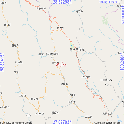
Wujing GPS coordinates[2]
27° 42' 8.028" North, 99° 32' 14.172" East
| Map corner | latitude | longitude |
|---|---|---|
| Upper-left | 28.32298°, | 98.83415° |
| Center: | 27.70223°, | 99.53727° |
| Lower-right: | 27.07793°, | 100.2404° |
| Map W x H: | 138.4×138.4 km | = 86×86mi |
| max Lat: | 53.31946° ⇑75.7% North |
| Wujing: | 27.70223° |
| min Lat: | ⇓24.3% South 18.22056° |
| min Long | Wujing | max Long |
| 75.07348° | 99.53727° | 134.28917° |
| W 5.2%⇐ | ⇒94.8% E |
Elevation
Elevation of Wujing is 3779 m = 12398 ft, and this is 3294.2 m = 10808 ft above average elevation for this country.
| Max E: |
5622 m = 18445 ft | 1.8% |
| Wujing | 3779 m 12398 ft | |
| Avg. | 484.8 m = 1591 ft | |
Min E: |
-3 m = -10 ft | 98.2% |
See also: China elevation on elevation.city.
Geographical zone
Wujing is located in North temperate zone (between Tropic of Cancer and the Arctic Circle). Distance of this Northern Tropic circle is 474.3 km =294.7 mi to South.| Distance of | km | miles | from Wujing |
|---|---|---|---|
| North Pole | 6926.9 | 4304.2 | to North |
| Arctic Circle | 4321 | 2684.9 | to North |
| Tropic Cancer | 474.3 | 294.7 | to South |
| Equator | 3080.2 | 1913.9 | to South |


Nearby cities:
15 places around Wujing: (largest is in red/bold)
• Badi
48.2 km =30 mi,  294°
294°
• Baohe
60.1 km =37.3 mi,  200°
200°
• Bengshutang
37.3 km =23.2 mi,  355°
355°
• Benzilan
61.6 km =38.3 mi,  344°
344°
• Geluwan
38.4 km =23.9 mi,  162°
162°
• Gezan
61.9 km =38.5 mi,  25°
25°
• Jiantang
26.5 km =16.5 mi,  59°
59°
• Kangpu
44.5 km =27.7 mi,  254°
254°
• Lazanzhong
60.8 km =37.8 mi,  18°
18°
• Shangri-La
21.6 km =13.4 mi,  50°
50°
• Shuijia
57 km =35.4 mi,  114°
114°
• Tuoding
9.1 km =5.7 mi,  314°
314°
• Xiaruo
21.3 km =13.2 mi,  303°
303°
• Yanmen
65.2 km =40.5 mi, 309°
• Yezhi
40.5 km =25.2 mi,  270°
270°
Sources, notices
• [Note1] Compared only with cities in China existing in our database
• [Src1] Map data: © OpenStreetMap contributors (CC-BY-SA)
• [Src2] Other city data from geonames.org with taken over terms of usage.
• [Src3] Geographical zone / Annual Mean Temperature by Robert A. Rohde @ Wikipedia
