Zhenyuan Chengguanzhen geodata
Zhenyuan Chengguanzhen (Gansu) is a seat of a third-order administrative division; located in China in Asia/Shanghai (GMT+8) time zone. In our database, there are 1268 cities with bigger population. Compared to other cities in China, 76.5% of cities are located further ↓South; 83.1% of cities are located further →East and 87.9% of cities have lower elevation than Zhenyuan Chengguanzhen. Note1
Current local time in Zhenyuan Chengguanzhen:
04:44 PM, TuesdayDifference from your time zone: hours


Zhenyuan Chengguanzhen GPS coordinates[2]
35° 40' 39" North, 107° 11' 47.004" East
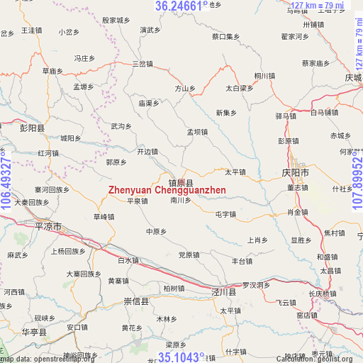
| Map corner | latitude | longitude |
|---|---|---|
| Upper-left | 36.24661°, | 106.49327° |
| Center: | 35.6775°, | 107.19639° |
| Lower-right: | 35.1043°, | 107.89952° |
| Map W x H: | 127×127 km | = 78.9×78.9mi |
| max Lat: | 53.31946° ⇑23.5% North |
| Zhenyuan Chengguanzhen: | 35.6775° |
| min Lat: | ⇓76.5% South 18.22056° |
| min Long | Zhenyuan Chengg | max Long |
| 75.07348° | 107.19639° | 134.28917° |
| W 16.9%⇐ | ⇒83.1% E |
Elevation
Elevation of Zhenyuan Chengguanzhen is 1178 m = 3865 ft, and this is 693.2 m = 2274 ft above average elevation for this country.
| Max E: |
5622 m = 18445 ft | 12.1% |
| Zhenyuan Chengguanzhen | 1178 m 3865 ft | |
| Avg. | 484.8 m = 1591 ft | |
Min E: |
-3 m = -10 ft | 87.9% |
See also: China elevation on elevation.city.
Geographical zone
Zhenyuan Chengguanzhen is located in North temperate zone (between Tropic of Cancer and the Arctic Circle). Distance of this Northern Tropic circle is 1361 km =845.7 mi to South.| Distance of | km | miles | from Zhenyuan Chengguanzhen |
|---|---|---|---|
| North Pole | 6040.1 | 3753.1 | to North |
| Arctic Circle | 3434.2 | 2133.9 | to North |
| Tropic Cancer | 1361 | 845.7 | to South |
| Equator | 3967 | 2465 | to South |


Nearby cities:
15 places around Zhenyuan Chengguanzhen: (largest is in red/bold)
• Baiyang
53.9 km =33.5 mi,  290°
290°
• Binglincha
43.4 km =27 mi,  21°
21°
• Caikouji
53.2 km =33.1 mi, 17°
• Caomiao
59.5 km =37 mi,  311°
311°
• Chengyang
40.4 km =25.1 mi, 292°
• Honghe
45.9 km =28.5 mi,  282°
282°
• Jingchuan Chengguanzhen
41.2 km =25.6 mi,  158°
158°
• Jinping
43.1 km =26.8 mi,  200°
200°
• Nanjie
40.1 km =24.9 mi,  80°
80°
• Pingliang
48.6 km =30.2 mi,  251°
251°
• Sancha
43.7 km =27.2 mi,  341°
341°
• Tongchuan
47.5 km =29.5 mi,  37°
37°
• Wuchengzi
47.3 km =29.4 mi,  7°
7°
• Yanwu
54.5 km =33.9 mi,  348°
348°
• Yinjiacheng
61.3 km =38.1 mi, 337°
Sources, notices
• [Note1] Compared only with cities in China existing in our database
• [Src1] Map data: © OpenStreetMap contributors (CC-BY-SA)
• [Src2] Other city data from geonames.org with taken over terms of usage.
• [Src3] Geographical zone / Annual Mean Temperature by Robert A. Rohde @ Wikipedia
