Yingdu geodata
Yingdu (Fujian) is a populated place; located in China in Asia/Shanghai (GMT+8) time zone. With population of 4,960 people, there are 873 cities with bigger population in this country. Compared to other cities in China, 86.5% of cities are located further ↑North; 71.7% of cities are located further ←West and 72.7% of cities have higher elevation than Yingdu. Note1


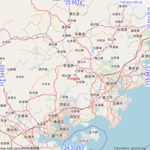
Yingdu GPS coordinates[2]
24° 58' 18.012" North, 118° 14' 39.012" East
| Map corner | latitude | longitude |
|---|---|---|
| Upper-left | 25.6074°, | 117.54105° |
| Center: | 24.97167°, | 118.24417° |
| Lower-right: | 24.33263°, | 118.9473° |
| Map W x H: | 141.7×141.7 km | = 88×88mi |
| max Lat: | 53.31946° ⇑86.5% North |
| Yingdu: | 24.97167° |
| min Lat: | ⇓13.5% South 18.22056° |
| min Long | Yingdu | max Long |
| 75.07348° | 118.24417° | 134.28917° |
| W 71.7%⇐ | ⇒28.3% E |
Elevation
Elevation of Yingdu is 43 m = 141 ft, and this is 441.8 m = 1449 ft below average elevation for this country.
| Max E: |
5622 m = 18445 ft | 72.7% |
| Avg. | 484.8 m = 1591 ft | |
| Yingdu | 43 m = 141 ft | |
Min E: |
-3 m = -10 ft | 27.3% |
See also: China elevation on elevation.city.
Geographical zone
Yingdu is located in North temperate zone (between Tropic of Cancer and the Arctic Circle). Distance of this Northern Tropic circle is 170.7 km =106.1 mi to South.| Distance of | km | miles | from Yingdu |
|---|---|---|---|
| North Pole | 7230.5 | 4492.8 | to North |
| Arctic Circle | 4624.6 | 2873.6 | to North |
| Tropic Cancer | 170.7 | 106.1 | to South |
| Equator | 2776.6 | 1725.3 | to South |


Nearby cities:
15 places around Yingdu: (largest is in red/bold)
• Cannei
11.5 km =7.1 mi,  345°
345°
• Chengxiang
9.8 km =6.1 mi,  325°
325°
• Fengcheng
11.3 km =7 mi, 326°
• Guanqiao
16.8 km =10.4 mi,  289°
289°
• Jintao
19.8 km =12.3 mi,  33°
33°
• Kangmei
24.1 km =15 mi,  71°
71°
• Kuidou
20.1 km =12.5 mi, 333°
• Longmen
15.7 km =9.8 mi,  265°
265°
• Luncang
5.6 km =3.5 mi,  41°
41°
• Meishan
13.8 km =8.6 mi, 25°
• Penglai
23.6 km =14.7 mi,  319°
319°
• Shengxin
15.7 km =9.8 mi,  62°
62°
• Xiamei
23.9 km =14.9 mi,  98°
98°
• Xiangyun
8.5 km =5.3 mi, 269°
• Ximei
14.4 km =8.9 mi,  82°
82°
Sources, notices
• [Note1] Compared only with cities in China existing in our database
• [Src1] Map data: © OpenStreetMap contributors (CC-BY-SA)
• [Src2] Other city data from geonames.org with taken over terms of usage.
• [Src3] Geographical zone / Annual Mean Temperature by Robert A. Rohde @ Wikipedia
