Longmen geodata
Longmen (Fujian) is a populated place; located in China in Asia/Shanghai (GMT+8) time zone. With population of 5,370 people, there are 861 cities with bigger population in this country. Compared to other cities in China, 86.5% of cities are located further ↑North; 71% of cities are located further ←West and 56.9% of cities have higher elevation than Longmen. Note1


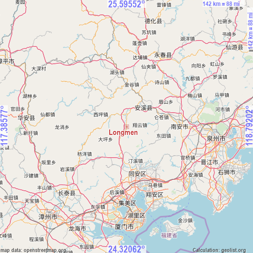
Longmen GPS coordinates[2]
24° 57' 34.992" North, 118° 5' 20.004" East
| Map corner | latitude | longitude |
|---|---|---|
| Upper-left | 25.59552°, | 117.38577° |
| Center: | 24.95972°, | 118.08889° |
| Lower-right: | 24.32062°, | 118.79202° |
| Map W x H: | 141.8×141.8 km | = 88.1×88.1mi |
| max Lat: | 53.31946° ⇑86.5% North |
| Longmen: | 24.95972° |
| min Lat: | ⇓13.5% South 18.22056° |
| min Long | Longmen | max Long |
| 75.07348° | 118.08889° | 134.28917° |
| W 71%⇐ | ⇒29% E |
Elevation
Elevation of Longmen is 118 m = 387 ft, and this is 366.8 m = 1203 ft below average elevation for this country.
| Max E: |
5622 m = 18445 ft | 56.9% |
| Avg. | 484.8 m = 1591 ft | |
| Longmen | 118 m = 387 ft | |
Min E: |
-3 m = -10 ft | 43.1% |
See also: China elevation on elevation.city.
Geographical zone
Longmen is located in North temperate zone (between Tropic of Cancer and the Arctic Circle). Distance of this Northern Tropic circle is 169.3 km =105.2 mi to South.| Distance of | km | miles | from Longmen |
|---|---|---|---|
| North Pole | 7231.8 | 4493.6 | to North |
| Arctic Circle | 4625.9 | 2874.4 | to North |
| Tropic Cancer | 169.3 | 105.2 | to South |
| Equator | 2775.3 | 1724.5 | to South |


Nearby cities:
15 places around Longmen: (largest is in red/bold)
• Cannei
17.9 km =11.1 mi,  45°
45°
• Chengxiang
13.9 km =8.6 mi, 47°
• Fengcheng
14.4 km =8.9 mi,  41°
41°
• Guanqiao
7 km =4.3 mi,  358°
358°
• Huqiu
11.1 km =6.9 mi,  295°
295°
• Jingu
23.8 km =14.8 mi,  6°
6°
• Kuidou
20.4 km =12.7 mi,  19°
19°
• Luncang
20.1 km =12.5 mi,  73°
73°
• Meishan
25.6 km =15.9 mi,  57°
57°
• Penglai
19.2 km =11.9 mi,  0°
0°
• Shangqing
20.9 km =13 mi,  323°
323°
• Wuxian
25.2 km =15.7 mi,  163°
163°
• Xiangyun
7.3 km =4.5 mi,  80°
80°
• Xiping
16.7 km =10.4 mi, 295°
• Yingdu
15.7 km =9.8 mi,  85°
85°
Sources, notices
• [Note1] Compared only with cities in China existing in our database
• [Src1] Map data: © OpenStreetMap contributors (CC-BY-SA)
• [Src2] Other city data from geonames.org with taken over terms of usage.
• [Src3] Geographical zone / Annual Mean Temperature by Robert A. Rohde @ Wikipedia
