Linshui geodata
Linshui (Hebei) is a populated place; located in China in Asia/Shanghai (GMT+8) time zone. With population of 109,955 people, there are 395 cities with bigger population in this country. Compared to other cities in China, 78.1% of cities are located further ↓South; 50.2% of cities are located further →East and 53.8% of cities have higher elevation than Linshui. Note1


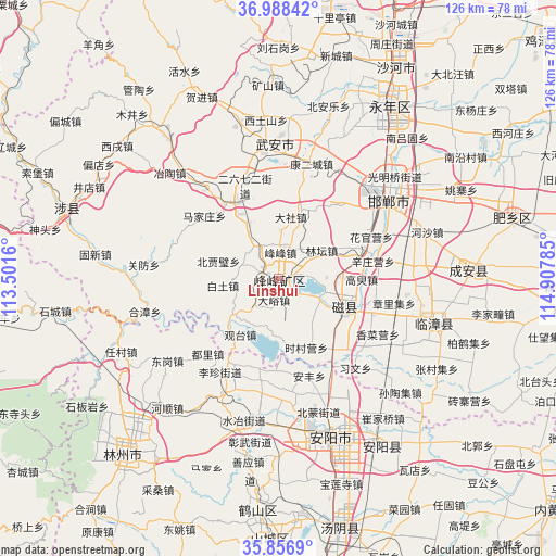
Linshui GPS coordinates[2]
36° 25' 28.992" North, 114° 12' 16.992" East
| Map corner | latitude | longitude |
|---|---|---|
| Upper-left | 36.98842°, | 113.5016° |
| Center: | 36.42472°, | 114.20472° |
| Lower-right: | 35.8569°, | 114.90785° |
| Map W x H: | 125.8×125.8 km | = 78.2×78.2mi |
| max Lat: | 53.31946° ⇑21.9% North |
| Linshui: | 36.42472° |
| min Lat: | ⇓78.1% South 18.22056° |
| min Long | Linshui | max Long |
| 75.07348° | 114.20472° | 134.28917° |
| W 49.8%⇐ | ⇒50.2% E |
Elevation
Elevation of Linshui is 138 m = 453 ft, and this is 346.8 m = 1138 ft below average elevation for this country.
| Max E: |
5622 m = 18445 ft | 53.8% |
| Avg. | 484.8 m = 1591 ft | |
| Linshui | 138 m = 453 ft | |
Min E: |
-3 m = -10 ft | 46.2% |
See also: Linshui elevation on elevation.city.
Geographical zone
Linshui is located in North temperate zone (between Tropic of Cancer and the Arctic Circle). Distance of this Northern Tropic circle is 1444.1 km =897.3 mi to South.| Distance of | km | miles | from Linshui |
|---|---|---|---|
| North Pole | 5957 | 3701.5 | to North |
| Arctic Circle | 3351.1 | 2082.3 | to North |
| Tropic Cancer | 1444.1 | 897.3 | to South |
| Equator | 4050 | 2516.6 | to South |


Nearby cities:
15 places around Linshui: (largest is in red/bold)
• Anyang
39.9 km =24.8 mi,  156°
156°
• Daming
85.5 km =53.1 mi,  100°
100°
• Handan
30.6 km =19 mi,  50°
50°
• Hebi
58.4 km =36.3 mi,  181°
181°
• Hecun
14.7 km =9.1 mi,  325°
325°
• Kaiyuan
52.4 km =32.6 mi,  220°
220°
• Lihou
75.2 km =46.7 mi,  276°
276°
• Luhua
88.4 km =54.9 mi,  263°
263°
• Neihuang Chengguanzhen
81.8 km =50.8 mi,  130°
130°
• Pengcheng
3.2 km =2 mi, 282°
• Qingyang
74.6 km =46.4 mi,  251°
251°
• Shahecheng
63.1 km =39.2 mi,  25°
25°
• Tangyang Chengguanzhen
58.3 km =36.2 mi,  166°
166°
• Xingtai
75.5 km =46.9 mi,  19°
19°
• Yigou
68.9 km =42.8 mi, 171°
Sources, notices
• [Note1] Compared only with cities in China existing in our database
• [Src1] Map data: © OpenStreetMap contributors (CC-BY-SA)
• [Src2] Other city data from geonames.org with taken over terms of usage.
• [Src3] Geographical zone / Annual Mean Temperature by Robert A. Rohde @ Wikipedia
