Yangcheng geodata
Yangcheng (Shanxi) is a seat of a third-order administrative division; located in China in Asia/Shanghai (GMT+8) time zone. In our database, there are 1268 cities with bigger population. Compared to other cities in China, 75.9% of cities are located further ↓South; 60.5% of cities are located further →East and 79.1% of cities have lower elevation than Yangcheng. Note1


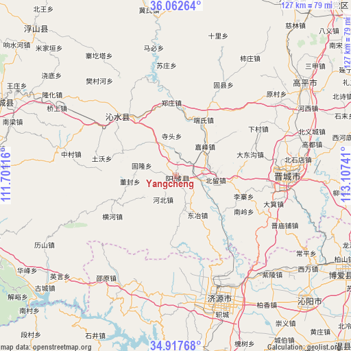
Yangcheng GPS coordinates[2]
35° 29' 31.92" North, 112° 24' 15.408" East
| Map corner | latitude | longitude |
|---|---|---|
| Upper-left | 36.06264°, | 111.70116° |
| Center: | 35.4922°, | 112.40428° |
| Lower-right: | 34.91768°, | 113.10741° |
| Map W x H: | 127.3×127.3 km | = 79.1×79.1mi |
| max Lat: | 53.31946° ⇑24.1% North |
| Yangcheng: | 35.4922° |
| min Lat: | ⇓75.9% South 18.22056° |
| min Long | Yangcheng | max Long |
| 75.07348° | 112.40428° | 134.28917° |
| W 39.5%⇐ | ⇒60.5% E |
Elevation
Elevation of Yangcheng is 655 m = 2149 ft, and this is 170.2 m = 558 ft above average elevation for this country.
| Max E: |
5622 m = 18445 ft | 20.9% |
| Yangcheng | 655 m 2149 ft | |
| Avg. | 484.8 m = 1591 ft | |
Min E: |
-3 m = -10 ft | 79.1% |
See also: China elevation on elevation.city.
Geographical zone
Yangcheng is located in North temperate zone (between Tropic of Cancer and the Arctic Circle). Distance of this Northern Tropic circle is 1340.4 km =832.9 mi to South.| Distance of | km | miles | from Yangcheng |
|---|---|---|---|
| North Pole | 6060.7 | 3765.9 | to North |
| Arctic Circle | 3454.8 | 2146.7 | to North |
| Tropic Cancer | 1340.4 | 832.9 | to South |
| Equator | 3946.4 | 2452.2 | to South |


Nearby cities:
15 places around Yangcheng: (largest is in red/bold)
• Beishidian
44.7 km =27.8 mi,  82°
82°
• Changping
55 km =34.2 mi,  120°
120°
• Changzhi
68.1 km =42.3 mi,  242°
242°
• Daqinglu
67.9 km =42.2 mi,  166°
166°
• Jincheng
38.8 km =24.1 mi,  88°
88°
• Jincun
45.4 km =28.2 mi, 88°
• Jiyuan
47.5 km =29.5 mi,  160°
160°
• Longgang
31.3 km =19.4 mi,  314°
314°
• Nancun
35.6 km =22.1 mi,  95°
95°
• Qinghua
69.9 km =43.4 mi, 121°
• Tanbei
66.2 km =41.1 mi,  132°
132°
• Tangxing
69.7 km =43.3 mi,  293°
293°
• Tiantan
73.2 km =45.5 mi,  316°
316°
• Xincheng
70.4 km =43.7 mi,  252°
252°
• Xixiang
55.6 km =34.5 mi, 131°
Sources, notices
• [Note1] Compared only with cities in China existing in our database
• [Src1] Map data: © OpenStreetMap contributors (CC-BY-SA)
• [Src2] Other city data from geonames.org with taken over terms of usage.
• [Src3] Geographical zone / Annual Mean Temperature by Robert A. Rohde @ Wikipedia
