Tiantan geodata
Tiantan (Shanxi) is a seat of a third-order administrative division; located in China in Asia/Shanghai (GMT+8) time zone. In our database, there are 1268 cities with bigger population. Compared to other cities in China, 77.1% of cities are located further ↓South; 63.3% of cities are located further →East and 82.8% of cities have lower elevation than Tiantan. Note1


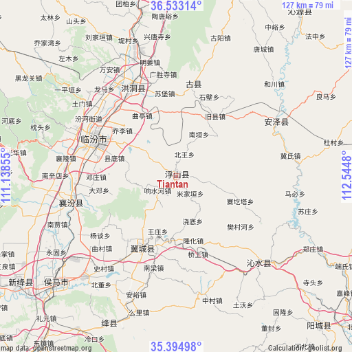
Tiantan GPS coordinates[2]
35° 57' 57.996" North, 111° 50' 30.012" East
| Map corner | latitude | longitude |
|---|---|---|
| Upper-left | 36.53314°, | 111.13855° |
| Center: | 35.96611°, | 111.84167° |
| Lower-right: | 35.39498°, | 112.5448° |
| Map W x H: | 126.6×126.6 km | = 78.7×78.7mi |
| max Lat: | 53.31946° ⇑22.9% North |
| Tiantan: | 35.96611° |
| min Lat: | ⇓77.1% South 18.22056° |
| min Long | Tiantan | max Long |
| 75.07348° | 111.84167° | 134.28917° |
| W 36.7%⇐ | ⇒63.3% E |
Elevation
Elevation of Tiantan is 835 m = 2740 ft, and this is 350.2 m = 1149 ft above average elevation for this country.
| Max E: |
5622 m = 18445 ft | 17.2% |
| Tiantan | 835 m 2740 ft | |
| Avg. | 484.8 m = 1591 ft | |
Min E: |
-3 m = -10 ft | 82.8% |
See also: China elevation on elevation.city.
Geographical zone
Tiantan is located in North temperate zone (between Tropic of Cancer and the Arctic Circle). Distance of this Northern Tropic circle is 1393.1 km =865.6 mi to South.| Distance of | km | miles | from Tiantan |
|---|---|---|---|
| North Pole | 6008 | 3733.2 | to North |
| Arctic Circle | 3402.1 | 2114 | to North |
| Tropic Cancer | 1393.1 | 865.6 | to South |
| Equator | 3999.1 | 2484.9 | to South |


Nearby cities:
15 places around Tiantan: (largest is in red/bold)
• Dadeng
28.1 km =17.5 mi,  259°
259°
• Dahuaishu
36.5 km =22.7 mi,  335°
335°
• Dengzhuang
28.7 km =17.8 mi,  269°
269°
• Fucheng
40.6 km =25.2 mi,  60°
60°
• Licun
41.7 km =25.9 mi,  236°
236°
• Linfen
32.1 km =19.9 mi,  295°
295°
• Longgang
41.9 km =26 mi,  137°
137°
• Nanxindian
43.4 km =27 mi, 270°
• Qucun
37.2 km =23.1 mi,  225°
225°
• Tangxing
27.7 km =17.2 mi,  207°
207°
• Taosi
31.8 km =19.8 mi, 256°
• Xiangling
40.3 km =25 mi,  279°
279°
• Xincheng
38 km =23.6 mi,  254°
254°
• Yangtan
34.6 km =21.5 mi, 232°
• Yueyang
36.6 km =22.7 mi,  10°
10°
Sources, notices
• [Note1] Compared only with cities in China existing in our database
• [Src1] Map data: © OpenStreetMap contributors (CC-BY-SA)
• [Src2] Other city data from geonames.org with taken over terms of usage.
• [Src3] Geographical zone / Annual Mean Temperature by Robert A. Rohde @ Wikipedia
