Xishan geodata
Xishan (Guizhou) is a populated place; located in China in Asia/Shanghai (GMT+8) time zone. With population of 1,452 people, there are 1097 cities with bigger population in this country. Compared to other cities in China, 83.6% of cities are located further ↑North; 76.4% of cities are located further →East and 57.4% of cities have lower elevation than Xishan. Note1


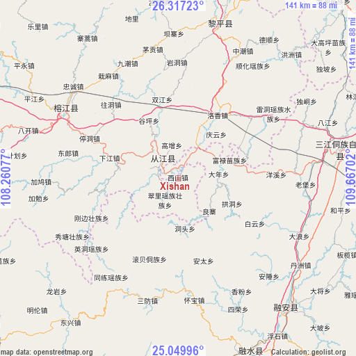
Xishan GPS coordinates[2]
25° 41' 7.008" North, 108° 57' 50.004" East
| Map corner | latitude | longitude |
|---|---|---|
| Upper-left | 26.31723°, | 108.26077° |
| Center: | 25.68528°, | 108.96389° |
| Lower-right: | 25.04996°, | 109.66702° |
| Map W x H: | 140.9×140.9 km | = 87.6×87.6mi |
| max Lat: | 53.31946° ⇑83.6% North |
| Xishan: | 25.68528° |
| min Lat: | ⇓16.4% South 18.22056° |
| min Long | Xishan | max Long |
| 75.07348° | 108.96389° | 134.28917° |
| W 23.6%⇐ | ⇒76.4% E |
Elevation
Elevation of Xishan is 229 m = 751 ft, and this is 255.8 m = 839 ft below average elevation for this country.
| Max E: |
5622 m = 18445 ft | 42.6% |
| Avg. | 484.8 m = 1591 ft | |
| Xishan | 229 m = 751 ft | |
Min E: |
-3 m = -10 ft | 57.4% |
See also: China elevation on elevation.city.
Geographical zone
Xishan is located in North temperate zone (between Tropic of Cancer and the Arctic Circle). Distance of this Northern Tropic circle is 250 km =155.3 mi to South.| Distance of | km | miles | from Xishan |
|---|---|---|---|
| North Pole | 7151.1 | 4443.5 | to North |
| Arctic Circle | 4545.2 | 2824.3 | to North |
| Tropic Cancer | 250 | 155.3 | to South |
| Equator | 2855.9 | 1774.6 | to South |


Nearby cities:
15 places around Xishan: (largest is in red/bold)
• Darong
14.9 km =9.3 mi,  317°
317°
• Dingdan
72.2 km =44.9 mi,  285°
285°
• Dundong
40.4 km =25.1 mi,  26°
26°
• Gaowu
14.8 km =9.2 mi,  202°
202°
• Gaozeng
13.2 km =8.2 mi,  348°
348°
• Guyi
64.6 km =40.1 mi,  80°
80°
• Hongzhou
66.2 km =41.1 mi,  42°
42°
• Pingjiang
33.3 km =20.7 mi, 294°
• Pingjiang
65.2 km =40.5 mi,  299°
299°
• Rong’an
65.6 km =40.8 mi,  140°
140°
• Shuangjiang
31.5 km =19.6 mi, 352°
• Tingdong
38.4 km =23.9 mi, 293°
• Xiajiang
28.3 km =17.6 mi, 286°
• Yongcong
43.1 km =26.8 mi,  22°
22°
• Zhongchao
56.4 km =35 mi, 26°
Sources, notices
• [Note1] Compared only with cities in China existing in our database
• [Src1] Map data: © OpenStreetMap contributors (CC-BY-SA)
• [Src2] Other city data from geonames.org with taken over terms of usage.
• [Src3] Geographical zone / Annual Mean Temperature by Robert A. Rohde @ Wikipedia
