Gaowu geodata
Gaowu (Guizhou) is a populated place; located in China in Asia/Shanghai (GMT+8) time zone. With population of 1,246 people, there are 1131 cities with bigger population in this country. Compared to other cities in China, 84% of cities are located further ↑North; 76.7% of cities are located further →East and 81.9% of cities have lower elevation than Gaowu. Note1


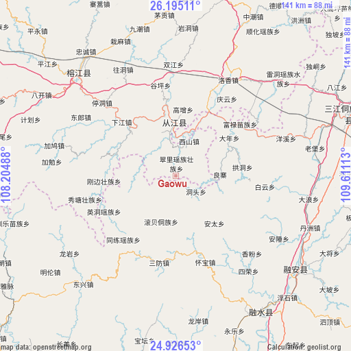
Gaowu GPS coordinates[2]
25° 33' 45" North, 108° 54' 28.8" East
| Map corner | latitude | longitude |
|---|---|---|
| Upper-left | 26.19511°, | 108.20488° |
| Center: | 25.5625°, | 108.908° |
| Lower-right: | 24.92653°, | 109.61113° |
| Map W x H: | 141.1×141.1 km | = 87.7×87.7mi |
| max Lat: | 53.31946° ⇑84% North |
| Gaowu: | 25.5625° |
| min Lat: | ⇓16% South 18.22056° |
| min Long | Gaowu | max Long |
| 75.07348° | 108.908° | 134.28917° |
| W 23.3%⇐ | ⇒76.7% E |
Elevation
Elevation of Gaowu is 787 m = 2582 ft, and this is 302.2 m = 991 ft above average elevation for this country.
| Max E: |
5622 m = 18445 ft | 18.1% |
| Gaowu | 787 m 2582 ft | |
| Avg. | 484.8 m = 1591 ft | |
Min E: |
-3 m = -10 ft | 81.9% |
See also: China elevation on elevation.city.
Geographical zone
Gaowu is located in North temperate zone (between Tropic of Cancer and the Arctic Circle). Distance of this Northern Tropic circle is 236.4 km =146.9 mi to South.| Distance of | km | miles | from Gaowu |
|---|---|---|---|
| North Pole | 7164.8 | 4452 | to North |
| Arctic Circle | 4558.9 | 2832.8 | to North |
| Tropic Cancer | 236.4 | 146.9 | to South |
| Equator | 2842.3 | 1766.1 | to South |


Nearby cities:
15 places around Gaowu: (largest is in red/bold)
• Darong
25.1 km =15.6 mi,  349°
349°
• Dingdan
71.9 km =44.7 mi,  296°
296°
• Dundong
55.1 km =34.2 mi,  25°
25°
• Gaozeng
26.8 km =16.7 mi,  6°
6°
• Guyi
73.4 km =45.6 mi,  70°
70°
• Pingjiang
37.1 km =23.1 mi,  318°
318°
• Pingjiang
68.5 km =42.6 mi,  311°
311°
• Rongshui
65 km =40.4 mi,  148°
148°
• Rong’an
60.2 km =37.4 mi,  127°
127°
• Shuangjiang
45 km =28 mi,  2°
2°
• Tingdong
41.5 km =25.8 mi, 314°
• Xiajiang
30.5 km =19 mi, 314°
• Xishan
14.8 km =9.2 mi,  22°
22°
• Yongcong
57.8 km =35.9 mi, 22°
• Zhongchao
71.1 km =44.2 mi, 26°
Sources, notices
• [Note1] Compared only with cities in China existing in our database
• [Src1] Map data: © OpenStreetMap contributors (CC-BY-SA)
• [Src2] Other city data from geonames.org with taken over terms of usage.
• [Src3] Geographical zone / Annual Mean Temperature by Robert A. Rohde @ Wikipedia
