Rong’an geodata
Rong’an (Guangxi) is a seat of a third-order administrative division; located in China in Asia/Shanghai (GMT+8) time zone. In our database, there are 1268 cities with bigger population. Compared to other cities in China, 85.4% of cities are located further ↑North; 74.5% of cities are located further →East and 56.3% of cities have higher elevation than Rong’an. Note1


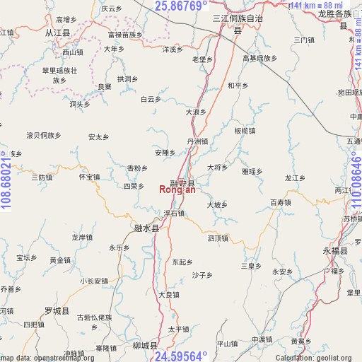
Rong’an GPS coordinates[2]
25° 13' 59.988" North, 109° 22' 59.988" East
| Map corner | latitude | longitude |
|---|---|---|
| Upper-left | 25.86769°, | 108.68021° |
| Center: | 25.23333°, | 109.38333° |
| Lower-right: | 24.59564°, | 110.08646° |
| Map W x H: | 141.4×141.4 km | = 87.9×87.9mi |
| max Lat: | 53.31946° ⇑85.4% North |
| Rong’an: | 25.23333° |
| min Lat: | ⇓14.6% South 18.22056° |
| min Long | Rong’an | max Long |
| 75.07348° | 109.38333° | 134.28917° |
| W 25.5%⇐ | ⇒74.5% E |
Elevation
Elevation of Rong’an is 122 m = 400 ft, and this is 362.8 m = 1190 ft below average elevation for this country.
| Max E: |
5622 m = 18445 ft | 56.3% |
| Avg. | 484.8 m = 1591 ft | |
| Rong’an | 122 m = 400 ft | |
Min E: |
-3 m = -10 ft | 43.7% |
See also: China elevation on elevation.city.
Geographical zone
Rong’an is located in North temperate zone (between Tropic of Cancer and the Arctic Circle). Distance of this Northern Tropic circle is 199.8 km =124.1 mi to South.| Distance of | km | miles | from Rong’an |
|---|---|---|---|
| North Pole | 7201.4 | 4474.7 | to North |
| Arctic Circle | 4595.5 | 2855.5 | to North |
| Tropic Cancer | 199.8 | 124.1 | to South |
| Equator | 2805.7 | 1743.4 | to South |


Nearby cities:
15 places around Rong’an: (largest is in red/bold)
• Dabu
64.7 km =40.2 mi,  193°
193°
• Darong
80.5 km =50 mi,  319°
319°
• Dongmen
69.1 km =42.9 mi,  224°
224°
• Dundong
89.9 km =55.9 mi,  344°
344°
• Gaowu
60.2 km =37.4 mi,  307°
307°
• Gaozeng
77.4 km =48.1 mi, 324°
• Guilin
91 km =56.5 mi,  86°
86°
• Guyi
64.3 km =40 mi,  19°
19°
• Longsheng
88.5 km =55 mi,  45°
45°
• Luzhai
89.1 km =55.4 mi,  156°
156°
• Rongshui
22.9 km =14.2 mi, 215°
• Xiajiang
90.5 km =56.2 mi, 309°
• Xishan
65.6 km =40.8 mi, 320°
• Yongcong
93.4 km =58 mi, 344°
• Yongfu
65.4 km =40.6 mi,  112°
112°
Sources, notices
• [Note1] Compared only with cities in China existing in our database
• [Src1] Map data: © OpenStreetMap contributors (CC-BY-SA)
• [Src2] Other city data from geonames.org with taken over terms of usage.
• [Src3] Geographical zone / Annual Mean Temperature by Robert A. Rohde @ Wikipedia
