Dacun geodata
Dacun (Sichuan) is a populated place; located in China in Asia/Shanghai (GMT+8) time zone. With population of 1,000 people, there are 1171 cities with bigger population in this country. Compared to other cities in China, 73.9% of cities are located further ↑North; 86.3% of cities are located further →East and 86.1% of cities have lower elevation than Dacun. Note1


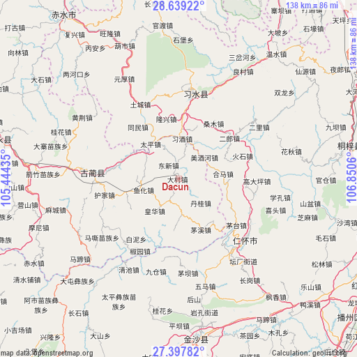
Dacun GPS coordinates[2]
28° 1' 13.116" North, 106° 8' 50.892" East
| Map corner | latitude | longitude |
|---|---|---|
| Upper-left | 28.63922°, | 105.44435° |
| Center: | 28.02031°, | 106.14747° |
| Lower-right: | 27.39782°, | 106.8506° |
| Map W x H: | 138×138 km | = 85.7×85.7mi |
| max Lat: | 53.31946° ⇑73.9% North |
| Dacun: | 28.02031° |
| min Lat: | ⇓26.1% South 18.22056° |
| min Long | Dacun | max Long |
| 75.07348° | 106.14747° | 134.28917° |
| W 13.7%⇐ | ⇒86.3% E |
Elevation
Elevation of Dacun is 1053 m = 3455 ft, and this is 568.2 m = 1864 ft above average elevation for this country.
| Max E: |
5622 m = 18445 ft | 13.9% |
| Dacun | 1053 m 3455 ft | |
| Avg. | 484.8 m = 1591 ft | |
Min E: |
-3 m = -10 ft | 86.1% |
See also: China elevation on elevation.city.
Geographical zone
Dacun is located in North temperate zone (between Tropic of Cancer and the Arctic Circle). Distance of this Northern Tropic circle is 509.6 km =316.7 mi to South.| Distance of | km | miles | from Dacun |
|---|---|---|---|
| North Pole | 6891.5 | 4282.2 | to North |
| Arctic Circle | 4285.6 | 2662.9 | to North |
| Tropic Cancer | 509.6 | 316.7 | to South |
| Equator | 3115.6 | 1935.9 | to South |


Nearby cities:
15 places around Dacun: (largest is in red/bold)
• Daba
27.5 km =17.1 mi,  90°
90°
• Donghuang
35.4 km =22 mi,  10°
10°
• Gulin
33.2 km =20.6 mi,  274°
274°
• Hema
17.8 km =11.1 mi,  83°
83°
• Huaqiu
45.9 km =28.5 mi, 76°
• Renhuai
35.6 km =22.1 mi,  135°
135°
• Sangmu
24.7 km =15.3 mi,  28°
28°
• Sanhe
20.4 km =12.7 mi,  74°
74°
• Sanyuanchang
37.1 km =23.1 mi,  1°
1°
• Shatan
15.3 km =9.5 mi,  49°
49°
• Taiping
17.2 km =10.7 mi,  321°
321°
• Tongmin
23.6 km =14.7 mi, 320°
• Tucheng
33.8 km =21 mi,  333°
333°
• Yong’an
34 km =21.1 mi, 53°
• Yuanhou
39.4 km =24.5 mi, 334°
Sources, notices
• [Note1] Compared only with cities in China existing in our database
• [Src1] Map data: © OpenStreetMap contributors (CC-BY-SA)
• [Src2] Other city data from geonames.org with taken over terms of usage.
• [Src3] Geographical zone / Annual Mean Temperature by Robert A. Rohde @ Wikipedia
