Shatan geodata
Shatan (Guizhou) is a populated place; located in China in Asia/Shanghai (GMT+8) time zone. With population of 660 people, there are 1239 cities with bigger population in this country. Compared to other cities in China, 73.2% of cities are located further ↑North; 85.9% of cities are located further →East and 80.9% of cities have lower elevation than Shatan. Note1


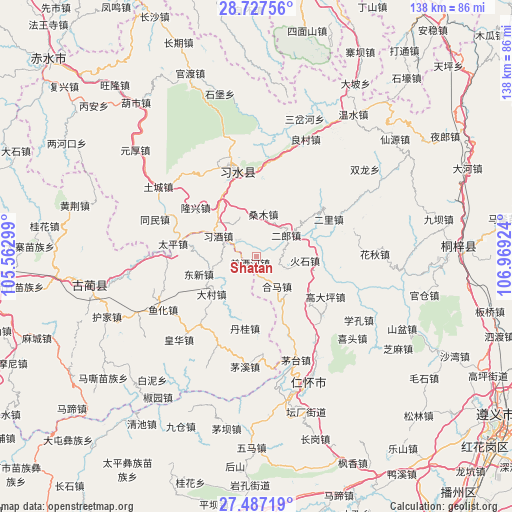
Shatan GPS coordinates[2]
28° 6' 33.012" North, 106° 15' 57.996" East
| Map corner | latitude | longitude |
|---|---|---|
| Upper-left | 28.72756°, | 105.56299° |
| Center: | 28.10917°, | 106.26611° |
| Lower-right: | 27.48719°, | 106.96924° |
| Map W x H: | 137.9×137.9 km | = 85.7×85.7mi |
| max Lat: | 53.31946° ⇑73.2% North |
| Shatan: | 28.10917° |
| min Lat: | ⇓26.8% South 18.22056° |
| min Long | Shatan | max Long |
| 75.07348° | 106.26611° | 134.28917° |
| W 14.1%⇐ | ⇒85.9% E |
Elevation
Elevation of Shatan is 735 m = 2411 ft, and this is 250.2 m = 821 ft above average elevation for this country.
| Max E: |
5622 m = 18445 ft | 19.1% |
| Shatan | 735 m 2411 ft | |
| Avg. | 484.8 m = 1591 ft | |
Min E: |
-3 m = -10 ft | 80.9% |
See also: China elevation on elevation.city.
Geographical zone
Shatan is located in North temperate zone (between Tropic of Cancer and the Arctic Circle). Distance of this Northern Tropic circle is 519.5 km =322.8 mi to South.| Distance of | km | miles | from Shatan |
|---|---|---|---|
| North Pole | 6881.6 | 4276 | to North |
| Arctic Circle | 4275.7 | 2656.8 | to North |
| Tropic Cancer | 519.5 | 322.8 | to South |
| Equator | 3125.4 | 1942 | to South |


Nearby cities:
15 places around Shatan: (largest is in red/bold)
• Daba
19 km =11.8 mi,  123°
123°
• Dacun
15.3 km =9.5 mi,  229°
229°
• Donghuang
25.4 km =15.8 mi,  348°
348°
• Hema
9.9 km =6.2 mi,  142°
142°
• Huaqiu
33 km =20.5 mi,  88°
88°
• Liangcunchang
36.5 km =22.7 mi,  25°
25°
• Renhuai
37.7 km =23.4 mi,  159°
159°
• Sangmu
11.8 km =7.3 mi,  1°
1°
• Sanhe
9.2 km =5.7 mi, 119°
• Sanyuanchang
29.2 km =18.1 mi,  339°
339°
• Taiping
22.7 km =14.1 mi,  278°
278°
• Tongmin
27.8 km =17.3 mi,  287°
287°
• Tucheng
33.6 km =20.9 mi,  307°
307°
• Yong’an
18.8 km =11.7 mi,  56°
56°
• Yuanhou
38.3 km =23.8 mi, 312°
Sources, notices
• [Note1] Compared only with cities in China existing in our database
• [Src1] Map data: © OpenStreetMap contributors (CC-BY-SA)
• [Src2] Other city data from geonames.org with taken over terms of usage.
• [Src3] Geographical zone / Annual Mean Temperature by Robert A. Rohde @ Wikipedia
