Xiaojiang geodata
Xiaojiang (Zhejiang) is a seat of a fourth-order administrative division; located in China in Asia/Shanghai (GMT+8) time zone. In our database, there are 1268 cities with bigger population. Compared to other cities in China, 61% of cities are located further ↑North; 88.2% of cities are located further ←West and 60.5% of cities have lower elevation than Xiaojiang. Note1


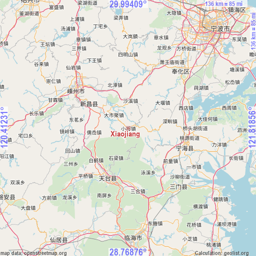
Xiaojiang GPS coordinates[2]
29° 22' 59.772" North, 121° 6' 55.548" East
| Map corner | latitude | longitude |
|---|---|---|
| Upper-left | 29.99409°, | 120.41231° |
| Center: | 29.38327°, | 121.11543° |
| Lower-right: | 28.76876°, | 121.81856° |
| Map W x H: | 136.2×136.2 km | = 84.6×84.6mi |
| max Lat: | 53.31946° ⇑61% North |
| Xiaojiang: | 29.38327° |
| min Lat: | ⇓39% South 18.22056° |
| min Long | Xiaojiang | max Long |
| 75.07348° | 121.11543° | 134.28917° |
| W 88.2%⇐ | ⇒11.8% E |
Elevation
Elevation of Xiaojiang is 266 m = 873 ft, and this is 218.8 m = 718 ft below average elevation for this country.
| Max E: |
5622 m = 18445 ft | 39.5% |
| Avg. | 484.8 m = 1591 ft | |
| Xiaojiang | 266 m = 873 ft | |
Min E: |
-3 m = -10 ft | 60.5% |
See also: China elevation on elevation.city.
Geographical zone
Xiaojiang is located in North temperate zone (between Tropic of Cancer and the Arctic Circle). Distance of this Northern Tropic circle is 661.2 km =410.9 mi to South.| Distance of | km | miles | from Xiaojiang |
|---|---|---|---|
| North Pole | 6739.9 | 4188 | to North |
| Arctic Circle | 4134.1 | 2568.8 | to North |
| Tropic Cancer | 661.2 | 410.9 | to South |
| Equator | 3267.1 | 2030.1 | to South |


Nearby cities:
15 places around Xiaojiang: (largest is in red/bold)
• Baihedian
24 km =14.9 mi,  226°
226°
• Beizhang
24.3 km =15.1 mi,  342°
342°
• Chalu
27.9 km =17.3 mi,  135°
135°
• Dashiju
10.4 km =6.5 mi,  310°
310°
• Dayan
22.6 km =14 mi,  52°
52°
• Feikeng
15.8 km =9.8 mi,  132°
132°
• Huangtan
25.5 km =15.8 mi,  112°
112°
• Huangze
28.6 km =17.8 mi,  319°
319°
• Ru’ao
19.4 km =12.1 mi,  262°
262°
• Shaxi
14.8 km =9.2 mi,  4°
4°
• Shenzhen
22 km =13.7 mi,  80°
80°
• Shiliang
17.3 km =10.7 mi,  203°
203°
• Tiantai Chengguanzhen
28.7 km =17.8 mi, 196°
• Xiaren
22.5 km =14 mi, 337°
• Xinchang Chengguanzhen
24.9 km =15.5 mi,  303°
303°
Sources, notices
• [Note1] Compared only with cities in China existing in our database
• [Src1] Map data: © OpenStreetMap contributors (CC-BY-SA)
• [Src2] Other city data from geonames.org with taken over terms of usage.
• [Src3] Geographical zone / Annual Mean Temperature by Robert A. Rohde @ Wikipedia
