Dayan geodata
Dayan (Zhejiang) is a seat of a fourth-order administrative division; located in China in Asia/Shanghai (GMT+8) time zone. In our database, there are 1268 cities with bigger population. Compared to other cities in China, 59.6% of cities are located further ↑North; 89.1% of cities are located further ←West and 59.4% of cities have lower elevation than Dayan. Note1


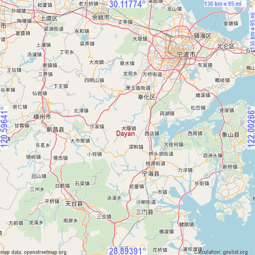
Dayan GPS coordinates[2]
29° 30' 27.612" North, 121° 17' 58.308" East
| Map corner | latitude | longitude |
|---|---|---|
| Upper-left | 30.11774°, | 120.59641° |
| Center: | 29.50767°, | 121.29953° |
| Lower-right: | 28.89391°, | 122.00266° |
| Map W x H: | 136.1×136.1 km | = 84.6×84.6mi |
| max Lat: | 53.31946° ⇑59.6% North |
| Dayan: | 29.50767° |
| min Lat: | ⇓40.4% South 18.22056° |
| min Long | Dayan | max Long |
| 75.07348° | 121.29953° | 134.28917° |
| W 89.1%⇐ | ⇒10.9% E |
Elevation
Elevation of Dayan is 252 m = 827 ft, and this is 232.8 m = 764 ft below average elevation for this country.
| Max E: |
5622 m = 18445 ft | 40.6% |
| Avg. | 484.8 m = 1591 ft | |
| Dayan | 252 m = 827 ft | |
Min E: |
-3 m = -10 ft | 59.4% |
See also: China elevation on elevation.city.
Geographical zone
Dayan is located in North temperate zone (between Tropic of Cancer and the Arctic Circle). Distance of this Northern Tropic circle is 675 km =419.4 mi to South.| Distance of | km | miles | from Dayan |
|---|---|---|---|
| North Pole | 6726.1 | 4179.4 | to North |
| Arctic Circle | 4120.2 | 2560.2 | to North |
| Tropic Cancer | 675 | 419.4 | to South |
| Equator | 3280.9 | 2038.7 | to South |


Nearby cities:
15 places around Dayan: (largest is in red/bold)
• Chunhu
22.3 km =13.9 mi,  69°
69°
• Dajiahe
25.8 km =16 mi,  109°
109°
• Feikeng
25.3 km =15.7 mi,  194°
194°
• Fenghua
19.5 km =12.1 mi,  32°
32°
• Huangtan
24.2 km =15 mi,  166°
166°
• Jinping
19.9 km =12.4 mi, 29°
• Shangtian
15.9 km =9.9 mi,  39°
39°
• Shaxi
16.6 km =10.3 mi,  273°
273°
• Shenzhen
10.9 km =6.8 mi,  159°
159°
• Xiaojiang
22.6 km =14 mi,  232°
232°
• Xiaowangmiao
22.2 km =13.8 mi,  14°
14°
• Xiashan
22.9 km =14.2 mi,  102°
102°
• Xidian
13.1 km =8.1 mi, 98°
• Xikou
19.9 km =12.4 mi,  352°
352°
• Xiwu
26.4 km =16.4 mi, 42°
Sources, notices
• [Note1] Compared only with cities in China existing in our database
• [Src1] Map data: © OpenStreetMap contributors (CC-BY-SA)
• [Src2] Other city data from geonames.org with taken over terms of usage.
• [Src3] Geographical zone / Annual Mean Temperature by Robert A. Rohde @ Wikipedia
