Xiangzhou geodata
Xiangzhou (Guangxi) is a seat of a third-order administrative division; located in China in Asia/Shanghai (GMT+8) time zone. In our database, there are 1268 cities with bigger population. Compared to other cities in China, 90.5% of cities are located further ↑North; 72.9% of cities are located further →East and 64.1% of cities have higher elevation than Xiangzhou. Note1


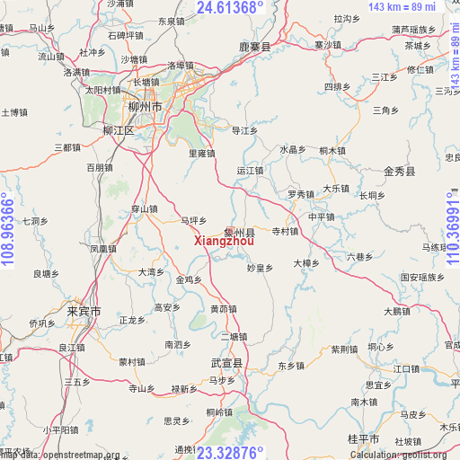
Xiangzhou GPS coordinates[2]
23° 58' 22.152" North, 109° 40' 0.408" East
| Map corner | latitude | longitude |
|---|---|---|
| Upper-left | 24.61368°, | 108.96366° |
| Center: | 23.97282°, | 109.66678° |
| Lower-right: | 23.32876°, | 110.36991° |
| Map W x H: | 142.9×142.9 km | = 88.8×88.8mi |
| max Lat: | 53.31946° ⇑90.5% North |
| Xiangzhou: | 23.97282° |
| min Lat: | ⇓9.5% South 18.22056° |
| min Long | Xiangzhou | max Long |
| 75.07348° | 109.66678° | 134.28917° |
| W 27.1%⇐ | ⇒72.9% E |
Elevation
Elevation of Xiangzhou is 77 m = 253 ft, and this is 407.8 m = 1338 ft below average elevation for this country.
| Max E: |
5622 m = 18445 ft | 64.1% |
| Avg. | 484.8 m = 1591 ft | |
| Xiangzhou | 77 m = 253 ft | |
Min E: |
-3 m = -10 ft | 35.9% |
See also: China elevation on elevation.city.
Geographical zone
Xiangzhou is located in North temperate zone (between Tropic of Cancer and the Arctic Circle). Distance of this Northern Tropic circle is 59.6 km =37 mi to South.| Distance of | km | miles | from Xiangzhou |
|---|---|---|---|
| North Pole | 7341.5 | 4561.8 | to North |
| Arctic Circle | 4735.6 | 2942.6 | to North |
| Tropic Cancer | 59.6 | 37 | to South |
| Equator | 2665.5 | 1656.3 | to South |


Nearby cities:
15 places around Xiangzhou: (largest is in red/bold)
• Dabu
88.7 km =55.1 mi,  330°
330°
• Guigang
97.6 km =60.6 mi,  183°
183°
• Guiping
76.6 km =47.6 mi,  147°
147°
• Jinxiu
55.2 km =34.3 mi,  70°
70°
• Labu
46.5 km =28.9 mi,  313°
313°
• Laibin
50.8 km =31.6 mi,  233°
233°
• Licheng
94.3 km =58.6 mi,  50°
50°
• Liuzhou
47.1 km =29.3 mi,  323°
323°
• Luorong
48.5 km =30.1 mi,  353°
353°
• Luzhai
58.7 km =36.5 mi,  6°
6°
• Mengshan
90.4 km =56.2 mi, 72°
• Pingnan
87.8 km =54.6 mi,  123°
123°
• Tantang
96.5 km =60 mi,  195°
195°
• Wuxuan
38.7 km =24 mi, 182°
• Xincheng Chengguanzhen
103.8 km =64.5 mi,  276°
276°
Sources, notices
• [Note1] Compared only with cities in China existing in our database
• [Src1] Map data: © OpenStreetMap contributors (CC-BY-SA)
• [Src2] Other city data from geonames.org with taken over terms of usage.
• [Src3] Geographical zone / Annual Mean Temperature by Robert A. Rohde @ Wikipedia
