Xiakeng geodata
Xiakeng (Anhui) is a seat of a fourth-order administrative division; located in China in Asia/Shanghai (GMT+8) time zone. In our database, there are 1268 cities with bigger population. Compared to other cities in China, 54.5% of cities are located further ↑North; 74.2% of cities are located further ←West and 53.1% of cities have higher elevation than Xiakeng. Note1


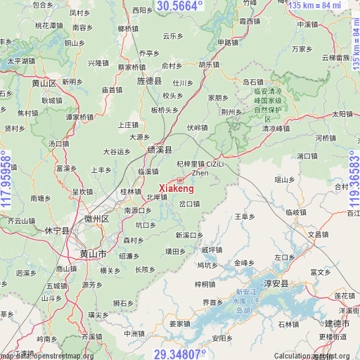
Xiakeng GPS coordinates[2]
29° 57' 32.76" North, 118° 39' 45.72" East
| Map corner | latitude | longitude |
|---|---|---|
| Upper-left | 30.5664°, | 117.95958° |
| Center: | 29.9591°, | 118.6627° |
| Lower-right: | 29.34807°, | 119.36583° |
| Map W x H: | 135.5×135.5 km | = 84.2×84.2mi |
| max Lat: | 53.31946° ⇑54.5% North |
| Xiakeng: | 29.9591° |
| min Lat: | ⇓45.5% South 18.22056° |
| min Long | Xiakeng | max Long |
| 75.07348° | 118.6627° | 134.28917° |
| W 74.2%⇐ | ⇒25.8% E |
Elevation
Elevation of Xiakeng is 143 m = 469 ft, and this is 341.8 m = 1121 ft below average elevation for this country.
| Max E: |
5622 m = 18445 ft | 53.1% |
| Avg. | 484.8 m = 1591 ft | |
| Xiakeng | 143 m = 469 ft | |
Min E: |
-3 m = -10 ft | 46.9% |
See also: China elevation on elevation.city.
Geographical zone
Xiakeng is located in North temperate zone (between Tropic of Cancer and the Arctic Circle). Distance of this Northern Tropic circle is 725.2 km =450.6 mi to South.| Distance of | km | miles | from Xiakeng |
|---|---|---|---|
| North Pole | 6675.9 | 4148.2 | to North |
| Arctic Circle | 4070 | 2529 | to North |
| Tropic Cancer | 725.2 | 450.6 | to South |
| Equator | 3331.1 | 2069.8 | to South |


Nearby cities:
15 places around Xiakeng: (largest is in red/bold)
• Bei’an
10 km =6.2 mi,  236°
236°
• Chakou
8.8 km =5.5 mi,  152°
152°
• Changxi
5.5 km =3.4 mi,  199°
199°
• Chengcunjiang
14.3 km =8.9 mi, 237°
• Huayang
14.2 km =8.8 mi,  330°
330°
• Jinchuan
17.8 km =11.1 mi,  82°
82°
• Linxi
12.7 km =7.9 mi,  285°
285°
• Qizili
8.9 km =5.5 mi,  57°
57°
• Sanyang
13.6 km =8.5 mi, 58°
• Shendu
11.3 km =7 mi,  206°
206°
• Sucun
4.6 km =2.9 mi, 58°
• Wuyang
12.5 km =7.8 mi,  184°
184°
• Xiaochuan
16.6 km =10.3 mi, 182°
• Yingzhou
11.5 km =7.1 mi,  351°
351°
• Zhupu
18.5 km =11.5 mi, 61°
Sources, notices
• [Note1] Compared only with cities in China existing in our database
• [Src1] Map data: © OpenStreetMap contributors (CC-BY-SA)
• [Src2] Other city data from geonames.org with taken over terms of usage.
• [Src3] Geographical zone / Annual Mean Temperature by Robert A. Rohde @ Wikipedia
