Yingzhou geodata
Yingzhou (Anhui) is a seat of a fourth-order administrative division; located in China in Asia/Shanghai (GMT+8) time zone. In our database, there are 1268 cities with bigger population. Compared to other cities in China, 53.4% of cities are located further ↑North; 74.1% of cities are located further ←West and 51.9% of cities have lower elevation than Yingzhou. Note1


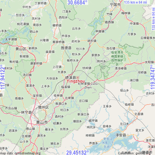
Yingzhou GPS coordinates[2]
30° 3' 42.228" North, 118° 38' 39.624" East
| Map corner | latitude | longitude |
|---|---|---|
| Upper-left | 30.6684°, | 117.94122° |
| Center: | 30.06173°, | 118.64434° |
| Lower-right: | 29.45132°, | 119.34747° |
| Map W x H: | 135.3×135.3 km | = 84.1×84.1mi |
| max Lat: | 53.31946° ⇑53.4% North |
| Yingzhou: | 30.06173° |
| min Lat: | ⇓46.6% South 18.22056° |
| min Long | Yingzhou | max Long |
| 75.07348° | 118.64434° | 134.28917° |
| W 74.1%⇐ | ⇒25.9% E |
Elevation
Elevation of Yingzhou is 180 m = 591 ft, and this is 304.8 m = 1000 ft below average elevation for this country.
| Max E: |
5622 m = 18445 ft | 48.1% |
| Avg. | 484.8 m = 1591 ft | |
| Yingzhou | 180 m = 591 ft | |
Min E: |
-3 m = -10 ft | 51.9% |
See also: China elevation on elevation.city.
Geographical zone
Yingzhou is located in North temperate zone (between Tropic of Cancer and the Arctic Circle). Distance of this Northern Tropic circle is 736.6 km =457.7 mi to South.| Distance of | km | miles | from Yingzhou |
|---|---|---|---|
| North Pole | 6664.5 | 4141.1 | to North |
| Arctic Circle | 4058.6 | 2521.9 | to North |
| Tropic Cancer | 736.6 | 457.7 | to South |
| Equator | 3342.6 | 2077 | to South |


Nearby cities:
15 places around Yingzhou: (largest is in red/bold)
• Banqiaotou
16 km =9.9 mi,  344°
344°
• Bei’an
18.1 km =11.2 mi,  201°
201°
• Chakou
20.1 km =12.5 mi,  162°
162°
• Changxi
16.6 km =10.3 mi,  180°
180°
• Chang’an
15.7 km =9.8 mi,  309°
309°
• Fuling
11.7 km =7.3 mi,  43°
43°
• Huayang
5.3 km =3.3 mi,  281°
281°
• Linxi
13.2 km =8.2 mi,  232°
232°
• Qizili
11.4 km =7.1 mi,  125°
125°
• Sanyang
14 km =8.7 mi,  107°
107°
• Sucun
10.6 km =6.6 mi,  147°
147°
• Xiakeng
11.5 km =7.1 mi,  171°
171°
• Xitou
18 km =11.2 mi,  251°
251°
• Yangxi
10.6 km =6.6 mi,  358°
358°
• Zhupu
18.3 km =11.4 mi,  98°
98°
Sources, notices
• [Note1] Compared only with cities in China existing in our database
• [Src1] Map data: © OpenStreetMap contributors (CC-BY-SA)
• [Src2] Other city data from geonames.org with taken over terms of usage.
• [Src3] Geographical zone / Annual Mean Temperature by Robert A. Rohde @ Wikipedia
