Wangmeng geodata
Wangmeng (Henan) is a seat of a fourth-order administrative division; located in China in Asia/Shanghai (GMT+8) time zone. In our database, there are 1268 cities with bigger population. Compared to other cities in China, 69.7% of cities are located further ↓South; 51.7% of cities are located further →East and 67.2% of cities have higher elevation than Wangmeng. Note1


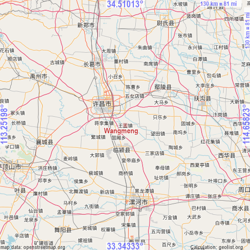
Wangmeng GPS coordinates[2]
33° 55' 43.428" North, 113° 57' 18.36" East
| Map corner | latitude | longitude |
|---|---|---|
| Upper-left | 34.51013°, | 113.25198° |
| Center: | 33.92873°, | 113.9551° |
| Lower-right: | 33.34333°, | 114.65823° |
| Map W x H: | 129.7×129.7 km | = 80.6×80.6mi |
| max Lat: | 53.31946° ⇑30.3% North |
| Wangmeng: | 33.92873° |
| min Lat: | ⇓69.7% South 18.22056° |
| min Long | Wangmeng | max Long |
| 75.07348° | 113.9551° | 134.28917° |
| W 48.3%⇐ | ⇒51.7% E |
Elevation
Elevation of Wangmeng is 64 m = 210 ft, and this is 420.8 m = 1381 ft below average elevation for this country.
| Max E: |
5622 m = 18445 ft | 67.2% |
| Avg. | 484.8 m = 1591 ft | |
| Wangmeng | 64 m = 210 ft | |
Min E: |
-3 m = -10 ft | 32.8% |
See also: China elevation on elevation.city.
Geographical zone
Wangmeng is located in North temperate zone (between Tropic of Cancer and the Arctic Circle). Distance of this Northern Tropic circle is 1166.6 km =724.9 mi to South.| Distance of | km | miles | from Wangmeng |
|---|---|---|---|
| North Pole | 6234.5 | 3873.9 | to North |
| Arctic Circle | 3628.7 | 2254.8 | to North |
| Tropic Cancer | 1166.6 | 724.9 | to South |
| Equator | 3772.5 | 2344.1 | to South |


Nearby cities:
15 places around Wangmeng: (largest is in red/bold)
• Anling
28.2 km =17.5 mi,  44°
44°
• Daguo
21.3 km =13.2 mi,  223°
223°
• Duqu
15.4 km =9.6 mi,  213°
213°
• Fanhu
26.9 km =16.7 mi,  249°
249°
• Guxiang
7 km =4.3 mi, 207°
• Huangdimiao
18.1 km =11.2 mi,  171°
171°
• Jiangguanchi
11.3 km =7 mi,  315°
315°
• Jiangliji
11.2 km =7 mi,  276°
276°
• Juling
7.4 km =4.6 mi,  176°
176°
• Shangqiao
24.8 km =15.4 mi, 179°
• Shenjian
26.6 km =16.5 mi,  291°
291°
• Shiqiao
5.3 km =3.3 mi,  265°
265°
• Taichen
18 km =11.2 mi,  189°
189°
• Xuchang
14.3 km =8.9 mi, 323°
• Zhangpan
7.8 km =4.8 mi,  24°
24°
Sources, notices
• [Note1] Compared only with cities in China existing in our database
• [Src1] Map data: © OpenStreetMap contributors (CC-BY-SA)
• [Src2] Other city data from geonames.org with taken over terms of usage.
• [Src3] Geographical zone / Annual Mean Temperature by Robert A. Rohde @ Wikipedia
