Tumba geodata
Tumba (Qinghai) is a seat of a fourth-order administrative division; located in China in Asia/Shanghai (GMT+8) time zone. In our database, there are 1268 cities with bigger population. Compared to other cities in China, 78% of cities are located further ↓South; 94% of cities are located further →East and 97.2% of cities have lower elevation than Tumba. Note1


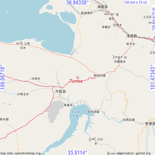
Tumba GPS coordinates[2]
36° 22' 46.38" North, 100° 46' 13.08" East
| Map corner | latitude | longitude |
|---|---|---|
| Upper-left | 36.94358°, | 100.06718° |
| Center: | 36.37955°, | 100.7703° |
| Lower-right: | 35.8114°, | 101.47343° |
| Map W x H: | 125.9×125.9 km | = 78.2×78.2mi |
| max Lat: | 53.31946° ⇑22% North |
| Tumba: | 36.37955° |
| min Lat: | ⇓78% South 18.22056° |
| min Long | Tumba | max Long |
| 75.07348° | 100.7703° | 134.28917° |
| W 6%⇐ | ⇒94% E |
Elevation
Elevation of Tumba is 3209 m = 10528 ft, and this is 2724.2 m = 8938 ft above average elevation for this country.
| Max E: |
5622 m = 18445 ft | 2.8% |
| Tumba | 3209 m 10528 ft | |
| Avg. | 484.8 m = 1591 ft | |
Min E: |
-3 m = -10 ft | 97.2% |
See also: China elevation on elevation.city.
Geographical zone
Tumba is located in North temperate zone (between Tropic of Cancer and the Arctic Circle). Distance of this Northern Tropic circle is 1439.1 km =894.2 mi to South.| Distance of | km | miles | from Tumba |
|---|---|---|---|
| North Pole | 5962 | 3704.6 | to North |
| Arctic Circle | 3356.1 | 2085.4 | to North |
| Tropic Cancer | 1439.1 | 894.2 | to South |
| Equator | 4045 | 2513.4 | to South |


Nearby cities:
15 places around Tumba: (largest is in red/bold)
• Dahua
52.7 km =32.7 mi,  48°
48°
• Daotanghe
17.6 km =10.9 mi,  82°
82°
• Gandi
36.7 km =22.8 mi,  273°
273°
• Heping
50.7 km =31.5 mi,  55°
55°
• Jiangxigou
53.1 km =33 mi,  302°
302°
• Lhakangtang
48.3 km =30 mi,  127°
127°
• Longyangxia
30.1 km =18.7 mi,  158°
158°
• Qabqa
17.8 km =11.1 mi,  232°
232°
• Qinghaihu
51.2 km =31.8 mi,  5°
5°
• Riyue
38.5 km =23.9 mi, 62°
• Sazhubxi
44.9 km =27.9 mi,  256°
256°
• Sizhai
46.4 km =28.8 mi,  29°
29°
• Tawan
46 km =28.6 mi,  41°
41°
• Tiegai
23 km =14.3 mi,  197°
197°
• Yingde’er
52.1 km =32.4 mi, 273°
Sources, notices
• [Note1] Compared only with cities in China existing in our database
• [Src1] Map data: © OpenStreetMap contributors (CC-BY-SA)
• [Src2] Other city data from geonames.org with taken over terms of usage.
• [Src3] Geographical zone / Annual Mean Temperature by Robert A. Rohde @ Wikipedia
