Loushanguan geodata
Loushanguan (Guizhou) is a seat of a third-order administrative division; located in China in Asia/Shanghai (GMT+8) time zone. With population of 80,344 people, there are 529 cities with bigger population in this country. Compared to other cities in China, 73% of cities are located further ↑North; 84.2% of cities are located further →East and 84.3% of cities have lower elevation than Loushanguan. Note1


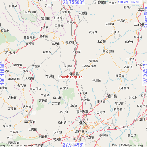
Loushanguan GPS coordinates[2]
28° 8' 12.48" North, 106° 49' 19.2" East
| Map corner | latitude | longitude |
|---|---|---|
| Upper-left | 28.75503°, | 106.11888° |
| Center: | 28.1368°, | 106.822° |
| Lower-right: | 27.51498°, | 107.52513° |
| Map W x H: | 137.9×137.9 km | = 85.7×85.7mi |
| max Lat: | 53.31946° ⇑73% North |
| Loushanguan: | 28.1368° |
| min Lat: | ⇓27% South 18.22056° |
| min Long | Loushanguan | max Long |
| 75.07348° | 106.822° | 134.28917° |
| W 15.8%⇐ | ⇒84.2% E |
Elevation
Elevation of Loushanguan is 935 m = 3068 ft, and this is 450.2 m = 1477 ft above average elevation for this country.
| Max E: |
5622 m = 18445 ft | 15.7% |
| Loushanguan | 935 m 3068 ft | |
| Avg. | 484.8 m = 1591 ft | |
Min E: |
-3 m = -10 ft | 84.3% |
See also: Loushanguan elevation on elevation.city.
Geographical zone
Loushanguan is located in North temperate zone (between Tropic of Cancer and the Arctic Circle). Distance of this Northern Tropic circle is 522.6 km =324.7 mi to South.| Distance of | km | miles | from Loushanguan |
|---|---|---|---|
| North Pole | 6878.5 | 4274.1 | to North |
| Arctic Circle | 4272.7 | 2654.9 | to North |
| Tropic Cancer | 522.6 | 324.7 | to South |
| Equator | 3128.5 | 1944 | to South |


Nearby cities:
15 places around Loushanguan: (largest is in red/bold)
• Chumi
10.8 km =6.7 mi,  5°
5°
• Daba
40.9 km =25.4 mi,  250°
250°
• Dahe
20.9 km =13 mi,  3°
3°
• Guancang
15.4 km =9.6 mi,  223°
223°
• Guandian
27.1 km =16.8 mi,  310°
310°
• Huangyang
30.5 km =19 mi,  54°
54°
• Huaqiu
21.7 km =13.5 mi,  264°
264°
• Jianba
22.4 km =13.9 mi,  106°
106°
• Liziba
8.9 km =5.5 mi,  319°
319°
• Maoya
34 km =21.1 mi,  98°
98°
• Taibai
39.8 km =24.7 mi,  40°
40°
• Xianyuan
35 km =21.7 mi, 321°
• Xinzhan
28.2 km =17.5 mi, 6°
• Yelang
29.8 km =18.5 mi,  351°
351°
• Yong’an
39.6 km =24.6 mi,  280°
280°
Sources, notices
• [Note1] Compared only with cities in China existing in our database
• [Src1] Map data: © OpenStreetMap contributors (CC-BY-SA)
• [Src2] Other city data from geonames.org with taken over terms of usage.
• [Src3] Geographical zone / Annual Mean Temperature by Robert A. Rohde @ Wikipedia
