Suojie geodata
Suojie (Hunan) is a seat of a fourth-order administrative division; located in China in Asia/Shanghai (GMT+8) time zone. In our database, there are 1268 cities with bigger population. Compared to other cities in China, 55.3% of cities are located further ↑North; 67.4% of cities are located further →East and 59.7% of cities have lower elevation than Suojie. Note1


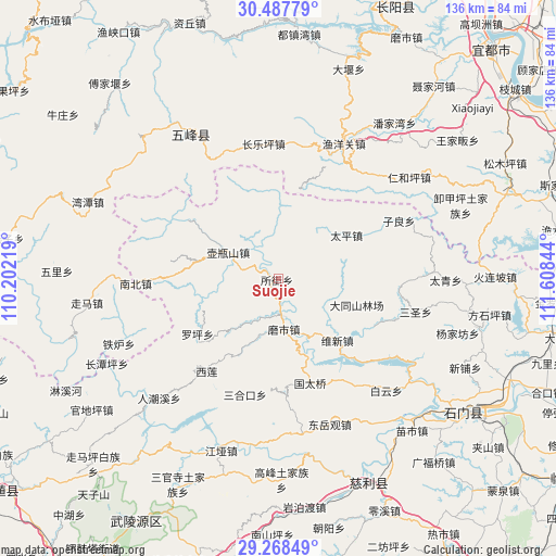
Suojie GPS coordinates[2]
29° 52' 48" North, 110° 54' 19.116" East
| Map corner | latitude | longitude |
|---|---|---|
| Upper-left | 30.48779°, | 110.20219° |
| Center: | 29.88°, | 110.90531° |
| Lower-right: | 29.26849°, | 111.60844° |
| Map W x H: | 135.6×135.6 km | = 84.3×84.3mi |
| max Lat: | 53.31946° ⇑55.3% North |
| Suojie: | 29.88° |
| min Lat: | ⇓44.7% South 18.22056° |
| min Long | Suojie | max Long |
| 75.07348° | 110.90531° | 134.28917° |
| W 32.6%⇐ | ⇒67.4% E |
Elevation
Elevation of Suojie is 256 m = 840 ft, and this is 228.8 m = 751 ft below average elevation for this country.
| Max E: |
5622 m = 18445 ft | 40.3% |
| Avg. | 484.8 m = 1591 ft | |
| Suojie | 256 m = 840 ft | |
Min E: |
-3 m = -10 ft | 59.7% |
See also: China elevation on elevation.city.
Geographical zone
Suojie is located in North temperate zone (between Tropic of Cancer and the Arctic Circle). Distance of this Northern Tropic circle is 716.4 km =445.2 mi to South.| Distance of | km | miles | from Suojie |
|---|---|---|---|
| North Pole | 6684.7 | 4153.7 | to North |
| Arctic Circle | 4078.8 | 2534.4 | to North |
| Tropic Cancer | 716.4 | 445.2 | to South |
| Equator | 3322.3 | 2064.4 | to South |


Nearby cities:
15 places around Suojie: (largest is in red/bold)
• Baishi
36.6 km =22.7 mi,  237°
237°
• Changleping
33.1 km =20.6 mi,  353°
353°
• Luojiaping
24.3 km =15.1 mi, 235°
• Moshi
13.6 km =8.5 mi,  161°
161°
• Nanzhen
34.4 km =21.4 mi,  268°
268°
• Nishi
13.7 km =8.5 mi,  296°
296°
• Sanhekou
29.2 km =18.1 mi,  195°
195°
• Sansheng
34 km =21.1 mi,  103°
103°
• Taiping
19.9 km =12.4 mi,  57°
57°
• Weixin
23.7 km =14.7 mi,  124°
124°
• Xilian
28.1 km =17.5 mi,  217°
217°
• Yanchi
9.3 km =5.8 mi,  165°
165°
• Yuyangguan
36.6 km =22.7 mi,  25°
25°
• Zhuangta
28 km =17.4 mi,  180°
180°
• Zilang
32.5 km =20.2 mi, 64°
Sources, notices
• [Note1] Compared only with cities in China existing in our database
• [Src1] Map data: © OpenStreetMap contributors (CC-BY-SA)
• [Src2] Other city data from geonames.org with taken over terms of usage.
• [Src3] Geographical zone / Annual Mean Temperature by Robert A. Rohde @ Wikipedia
