Suicheng geodata
Suicheng (Jiangsu) is a seat of a third-order administrative division; located in China in Asia/Shanghai (GMT+8) time zone. With population of 61,430 people, there are 712 cities with bigger population in this country. Compared to other cities in China, 69.6% of cities are located further ↓South; 70.3% of cities are located further ←West and 82.1% of cities have higher elevation than Suicheng. Note1


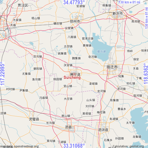
Suicheng GPS coordinates[2]
33° 53' 46.68" North, 117° 55' 59.052" East
| Map corner | latitude | longitude |
|---|---|---|
| Upper-left | 34.47793°, | 117.22995° |
| Center: | 33.8963°, | 117.93307° |
| Lower-right: | 33.31068°, | 118.6362° |
| Map W x H: | 129.8×129.8 km | = 80.7×80.7mi |
| max Lat: | 53.31946° ⇑30.4% North |
| Suicheng: | 33.8963° |
| min Lat: | ⇓69.6% South 18.22056° |
| min Long | Suicheng | max Long |
| 75.07348° | 117.93307° | 134.28917° |
| W 70.3%⇐ | ⇒29.7% E |
Elevation
Elevation of Suicheng is 22 m = 72 ft, and this is 462.8 m = 1518 ft below average elevation for this country.
| Max E: |
5622 m = 18445 ft | 82.1% |
| Avg. | 484.8 m = 1591 ft | |
| Suicheng | 22 m = 72 ft | |
Min E: |
-3 m = -10 ft | 17.9% |
See also: Suicheng elevation on elevation.city.
Geographical zone
Suicheng is located in North temperate zone (between Tropic of Cancer and the Arctic Circle). Distance of this Northern Tropic circle is 1163 km =722.7 mi to South.| Distance of | km | miles | from Suicheng |
|---|---|---|---|
| North Pole | 6238.1 | 3876.2 | to North |
| Arctic Circle | 3632.3 | 2257 | to North |
| Tropic Cancer | 1163 | 722.7 | to South |
| Equator | 3768.9 | 2341.9 | to South |


Nearby cities:
15 places around Suicheng: (largest is in red/bold)
• Bolinzi
44.1 km =27.4 mi,  250°
250°
• Guiren
34.5 km =21.4 mi,  136°
136°
• Guzhen Chengguanzhen
87 km =54.1 mi,  221°
221°
• Jiuli
85.6 km =53.2 mi,  301°
301°
• Lingcheng
54.4 km =33.8 mi, 222°
• Longcheng
96 km =59.7 mi,  289°
289°
• Pizhou
46.2 km =28.7 mi,  1°
1°
• Shucheng
82 km =51 mi,  72°
72°
• Sicheng
45.8 km =28.5 mi,  188°
188°
• Suzhou
92.8 km =57.7 mi, 251°
• Tancheng
88.2 km =54.8 mi,  24°
24°
• Tongshan
78.2 km =48.6 mi, 293°
• Wuhe Chengguanzhen
84.5 km =52.5 mi,  184°
184°
• Xuzhou
68.9 km =42.8 mi, 299°
• Zhongxing
72.2 km =44.9 mi,  107°
107°
Sources, notices
• [Note1] Compared only with cities in China existing in our database
• [Src1] Map data: © OpenStreetMap contributors (CC-BY-SA)
• [Src2] Other city data from geonames.org with taken over terms of usage.
• [Src3] Geographical zone / Annual Mean Temperature by Robert A. Rohde @ Wikipedia
