Shuidatian geodata
Shuidatian (Hunan) is a populated place; located in China in Asia/Shanghai (GMT+8) time zone. With population of 1,080 people, there are 1161 cities with bigger population in this country. Compared to other cities in China, 74.9% of cities are located further ↑North; 73.3% of cities are located further →East and 59.7% of cities have lower elevation than Shuidatian. Note1


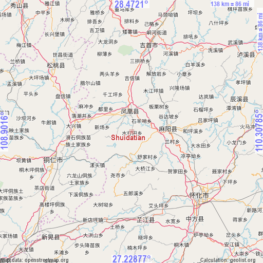
Shuidatian GPS coordinates[2]
27° 51' 7.992" North, 109° 36' 16.992" East
| Map corner | latitude | longitude |
|---|---|---|
| Upper-left | 28.4721°, | 108.9016° |
| Center: | 27.85222°, | 109.60472° |
| Lower-right: | 27.22877°, | 110.30785° |
| Map W x H: | 138.2×138.2 km | = 85.9×85.9mi |
| max Lat: | 53.31946° ⇑74.9% North |
| Shuidatian: | 27.85222° |
| min Lat: | ⇓25.1% South 18.22056° |
| min Long | Shuidatian | max Long |
| 75.07348° | 109.60472° | 134.28917° |
| W 26.7%⇐ | ⇒73.3% E |
Elevation
Elevation of Shuidatian is 256 m = 840 ft, and this is 228.8 m = 751 ft below average elevation for this country.
| Max E: |
5622 m = 18445 ft | 40.3% |
| Avg. | 484.8 m = 1591 ft | |
| Shuidatian | 256 m = 840 ft | |
Min E: |
-3 m = -10 ft | 59.7% |
See also: China elevation on elevation.city.
Geographical zone
Shuidatian is located in North temperate zone (between Tropic of Cancer and the Arctic Circle). Distance of this Northern Tropic circle is 491 km =305.1 mi to South.| Distance of | km | miles | from Shuidatian |
|---|---|---|---|
| North Pole | 6910.2 | 4293.8 | to North |
| Arctic Circle | 4304.3 | 2674.6 | to North |
| Tropic Cancer | 491 | 305.1 | to South |
| Equator | 3096.9 | 1924.3 | to South |


Nearby cities:
15 places around Shuidatian: (largest is in red/bold)
• Banpan
26.2 km =16.3 mi,  310°
310°
• Chatian
23.4 km =14.5 mi,  256°
256°
• Fenghuang
9.3 km =5.8 mi,  356°
356°
• Gaocun
17.9 km =11.1 mi,  81°
81°
• Jiangkouxu
21.8 km =13.5 mi,  143°
143°
• Jinhe
15 km =9.3 mi,  180°
180°
• Jixin
28.4 km =17.6 mi,  0°
0°
• Mujiangping
24.7 km =15.3 mi,  27°
27°
• Qiangongping
22.2 km =13.8 mi,  332°
332°
• Qiaoxikou
22.6 km =14 mi,  19°
19°
• Shanjiang
25.7 km =16 mi, 327°
• Tuojiang
12 km =7.5 mi,  342°
342°
• Yangtou
26.1 km =16.2 mi,  226°
226°
• Yanmen
13.3 km =8.3 mi,  88°
88°
• Yaoshi
24.8 km =15.4 mi,  197°
197°
Sources, notices
• [Note1] Compared only with cities in China existing in our database
• [Src1] Map data: © OpenStreetMap contributors (CC-BY-SA)
• [Src2] Other city data from geonames.org with taken over terms of usage.
• [Src3] Geographical zone / Annual Mean Temperature by Robert A. Rohde @ Wikipedia
