Shaping geodata
Shaping (Guangdong) is a seat of a third-order administrative division; located in China in Asia/Shanghai (GMT+8) time zone. With population of 107,589 people, there are 409 cities with bigger population in this country. Compared to other cities in China, 95.4% of cities are located further ↑North; 57.8% of cities are located further →East and 91.2% of cities have higher elevation than Shaping. Note1


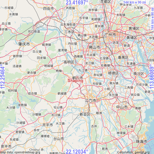
Shaping GPS coordinates[2]
22° 46' 12.684" North, 112° 57' 27.936" East
| Map corner | latitude | longitude |
|---|---|---|
| Upper-left | 23.41697°, | 112.25464° |
| Center: | 22.77019°, | 112.95776° |
| Lower-right: | 22.12034°, | 113.66089° |
| Map W x H: | 144.2×144.2 km | = 89.6×89.6mi |
| max Lat: | 53.31946° ⇑95.4% North |
| Shaping: | 22.77019° |
| min Lat: | ⇓4.6% South 18.22056° |
| min Long | Shaping | max Long |
| 75.07348° | 112.95776° | 134.28917° |
| W 42.2%⇐ | ⇒57.8% E |
Elevation
Elevation of Shaping is 9 m = 30 ft, and this is 475.8 m = 1561 ft below average elevation for this country.
| Max E: |
5622 m = 18445 ft | 91.2% |
| Avg. | 484.8 m = 1591 ft | |
| Shaping | 9 m = 30 ft | |
Min E: |
-3 m = -10 ft | 8.8% |
See also: Shaping elevation on elevation.city.
Geographical zone
Shaping is located in North Torrid zone (between Equator and Tropic of Cancer). Distance of this Northern Tropic circle is 74.1 km =46 mi to North.| Distance of | km | miles | from Shaping |
|---|---|---|---|
| North Pole | 7475.3 | 4644.9 | to North |
| Arctic Circle | 4869.4 | 3025.7 | to North |
| Tropic Cancer | 74.1 | 46 | to North |
| Equator | 2531.8 | 1573.2 | to South |


Nearby cities:
15 places around Shaping: (largest is in red/bold)
• Duruan
19.1 km =11.9 mi,  163°
163°
• Gulao
7.6 km =4.7 mi,  341°
341°
• Hecheng
16.7 km =10.4 mi,  333°
333°
• Hecheng
20.6 km =12.8 mi,  225°
225°
• Jiujiang
8.9 km =5.5 mi,  34°
34°
• Jun’an
20.7 km =12.9 mi,  110°
110°
• Leliu
19.3 km =12 mi,  58°
58°
• Longjiang
17.2 km =10.7 mi,  41°
41°
• Longkou
5.2 km =3.2 mi,  274°
274°
• Tangxia
12.4 km =7.7 mi,  142°
142°
• Taoyuan
7.1 km =4.4 mi,  221°
221°
• Xingtan
19.2 km =11.9 mi,  85°
85°
• Xiqiao
19.6 km =12.2 mi,  2°
2°
• Yanghe
20.2 km =12.6 mi,  302°
302°
• Yayao
8.2 km =5.1 mi, 142°
Sources, notices
• [Note1] Compared only with cities in China existing in our database
• [Src1] Map data: © OpenStreetMap contributors (CC-BY-SA)
• [Src2] Other city data from geonames.org with taken over terms of usage.
• [Src3] Geographical zone / Annual Mean Temperature by Robert A. Rohde @ Wikipedia
