Shanghu geodata
Shanghu (Zhejiang) is a seat of a fourth-order administrative division; located in China in Asia/Shanghai (GMT+8) time zone. In our database, there are 1268 cities with bigger population. Compared to other cities in China, 63.8% of cities are located further ↑North; 86% of cities are located further ←West and 75.9% of cities have lower elevation than Shanghu. Note1


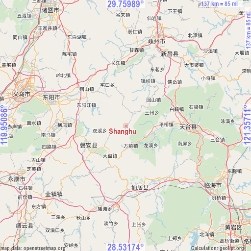
Shanghu GPS coordinates[2]
29° 8' 51.54" North, 120° 39' 14.328" East
| Map corner | latitude | longitude |
|---|---|---|
| Upper-left | 29.75989°, | 119.95086° |
| Center: | 29.14765°, | 120.65398° |
| Lower-right: | 28.53174°, | 121.35711° |
| Map W x H: | 136.6×136.6 km | = 84.9×84.9mi |
| max Lat: | 53.31946° ⇑63.8% North |
| Shanghu: | 29.14765° |
| min Lat: | ⇓36.2% South 18.22056° |
| min Long | Shanghu | max Long |
| 75.07348° | 120.65398° | 134.28917° |
| W 86%⇐ | ⇒14% E |
Elevation
Elevation of Shanghu is 544 m = 1785 ft, and this is 59.2 m = 194 ft above average elevation for this country.
| Max E: |
5622 m = 18445 ft | 24.1% |
| Shanghu | 544 m 1785 ft | |
| Avg. | 484.8 m = 1591 ft | |
Min E: |
-3 m = -10 ft | 75.9% |
See also: China elevation on elevation.city.
Geographical zone
Shanghu is located in North temperate zone (between Tropic of Cancer and the Arctic Circle). Distance of this Northern Tropic circle is 635 km =394.6 mi to South.| Distance of | km | miles | from Shanghu |
|---|---|---|---|
| North Pole | 6766.1 | 4204.3 | to North |
| Arctic Circle | 4160.3 | 2585.1 | to North |
| Tropic Cancer | 635 | 394.6 | to South |
| Equator | 3240.9 | 2013.8 | to South |


Nearby cities:
15 places around Shanghu: (largest is in red/bold)
• Anwen
23.2 km =14.4 mi,  244°
244°
• Dianqian
24.6 km =15.3 mi,  30°
30°
• Diji
17 km =10.6 mi,  352°
352°
• Fangqian
11 km =6.8 mi,  166°
166°
• Guangdu
23.4 km =14.5 mi,  158°
158°
• Jianshan
10.5 km =6.5 mi,  35°
35°
• Jietou
15 km =9.3 mi,  103°
103°
• Panfeng
25.7 km =16 mi,  205°
205°
• Pan’an
23.5 km =14.6 mi, 243°
• Pingqiao
22 km =13.7 mi,  88°
88°
• Weixin
24.2 km =15 mi,  189°
189°
• Xichou
23.6 km =14.7 mi,  297°
297°
• Xinshichang
20.9 km =13 mi,  45°
45°
• Xuetian
18.3 km =11.4 mi, 209°
• Zuocun
25 km =15.5 mi,  322°
322°
Sources, notices
• [Note1] Compared only with cities in China existing in our database
• [Src1] Map data: © OpenStreetMap contributors (CC-BY-SA)
• [Src2] Other city data from geonames.org with taken over terms of usage.
• [Src3] Geographical zone / Annual Mean Temperature by Robert A. Rohde @ Wikipedia
