Sankou geodata
Sankou (Zhejiang) is a seat of a fourth-order administrative division; located in China in Asia/Shanghai (GMT+8) time zone. In our database, there are 1268 cities with bigger population. Compared to other cities in China, 53% of cities are located further ↑North; 80.2% of cities are located further ←West and 68.9% of cities have higher elevation than Sankou. Note1


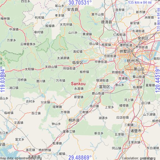
Sankou GPS coordinates[2]
30° 5' 55.932" North, 119° 44' 31.416" East
| Map corner | latitude | longitude |
|---|---|---|
| Upper-left | 30.70531°, | 119.03894° |
| Center: | 30.09887°, | 119.74206° |
| Lower-right: | 29.48869°, | 120.44519° |
| Map W x H: | 135.3×135.3 km | = 84.1×84.1mi |
| max Lat: | 53.31946° ⇑53% North |
| Sankou: | 30.09887° |
| min Lat: | ⇓47% South 18.22056° |
| min Long | Sankou | max Long |
| 75.07348° | 119.74206° | 134.28917° |
| W 80.2%⇐ | ⇒19.8% E |
Elevation
Elevation of Sankou is 56 m = 184 ft, and this is 428.8 m = 1407 ft below average elevation for this country.
| Max E: |
5622 m = 18445 ft | 68.9% |
| Avg. | 484.8 m = 1591 ft | |
| Sankou | 56 m = 184 ft | |
Min E: |
-3 m = -10 ft | 31.1% |
See also: China elevation on elevation.city.
Geographical zone
Sankou is located in North temperate zone (between Tropic of Cancer and the Arctic Circle). Distance of this Northern Tropic circle is 740.8 km =460.3 mi to South.| Distance of | km | miles | from Sankou |
|---|---|---|---|
| North Pole | 6660.4 | 4138.6 | to North |
| Arctic Circle | 4054.5 | 2519.3 | to North |
| Tropic Cancer | 740.8 | 460.3 | to South |
| Equator | 3346.7 | 2079.5 | to South |


Nearby cities:
15 places around Sankou: (largest is in red/bold)
• Banqiao
8.4 km =5.2 mi,  26°
26°
• Chunjian
8.5 km =5.3 mi,  107°
107°
• Dongqiao
15.5 km =9.6 mi,  260°
260°
• Fuyang
20.8 km =12.9 mi,  104°
104°
• Gaoqiao
18.7 km =11.6 mi,  88°
88°
• Linglong
14.3 km =8.9 mi,  315°
315°
• Lin’an
15.4 km =9.6 mi,  351°
351°
• Lushan
18.5 km =11.5 mi,  122°
122°
• Qingshanhu
18.2 km =11.3 mi,  21°
21°
• Shanggan
8.8 km =5.5 mi,  340°
340°
• Shoujiang
21.1 km =13.1 mi,  81°
81°
• Wanshi
16.7 km =10.4 mi,  269°
269°
• Xindeng
14.2 km =8.8 mi,  185°
185°
• Xukou
14.7 km =9.1 mi,  209°
209°
• Yongchang
6.8 km =4.2 mi, 188°
Sources, notices
• [Note1] Compared only with cities in China existing in our database
• [Src1] Map data: © OpenStreetMap contributors (CC-BY-SA)
• [Src2] Other city data from geonames.org with taken over terms of usage.
• [Src3] Geographical zone / Annual Mean Temperature by Robert A. Rohde @ Wikipedia
