Renhua geodata
Renhua (Guangdong) is a seat of a third-order administrative division; located in China in Asia/Shanghai (GMT+8) time zone. In our database, there are 1268 cities with bigger population. Compared to other cities in China, 86% of cities are located further ↑North; 52.9% of cities are located further →East and 58.5% of cities have higher elevation than Renhua. Note1


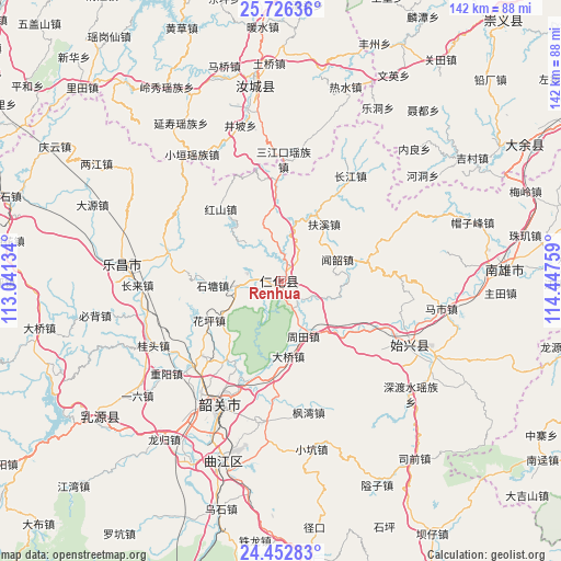
Renhua GPS coordinates[2]
25° 5' 28.5" North, 113° 44' 40.056" East
| Map corner | latitude | longitude |
|---|---|---|
| Upper-left | 25.72636°, | 113.04134° |
| Center: | 25.09125°, | 113.74446° |
| Lower-right: | 24.45283°, | 114.44759° |
| Map W x H: | 141.6×141.6 km | = 88×88mi |
| max Lat: | 53.31946° ⇑86% North |
| Renhua: | 25.09125° |
| min Lat: | ⇓14% South 18.22056° |
| min Long | Renhua | max Long |
| 75.07348° | 113.74446° | 134.28917° |
| W 47.1%⇐ | ⇒52.9% E |
Elevation
Elevation of Renhua is 108 m = 354 ft, and this is 376.8 m = 1236 ft below average elevation for this country.
| Max E: |
5622 m = 18445 ft | 58.5% |
| Avg. | 484.8 m = 1591 ft | |
| Renhua | 108 m = 354 ft | |
Min E: |
-3 m = -10 ft | 41.5% |
See also: China elevation on elevation.city.
Geographical zone
Renhua is located in North temperate zone (between Tropic of Cancer and the Arctic Circle). Distance of this Northern Tropic circle is 184 km =114.3 mi to South.| Distance of | km | miles | from Renhua |
|---|---|---|---|
| North Pole | 7217.2 | 4484.6 | to North |
| Arctic Circle | 4611.3 | 2865.3 | to North |
| Tropic Cancer | 184 | 114.3 | to South |
| Equator | 2789.9 | 1733.6 | to South |


Nearby cities:
15 places around Renhua: (largest is in red/bold)
• Baishun
30.5 km =19 mi,  68°
68°
• Chengkou
25.6 km =15.9 mi,  358°
358°
• Danxia
4.9 km =3 mi,  175°
175°
• Daqiao
20.1 km =12.5 mi, 176°
• Dongtang
11.5 km =7.1 mi,  264°
264°
• Fuxi
18.1 km =11.2 mi,  39°
39°
• Hongshan
23.8 km =14.8 mi,  320°
320°
• Huangkeng
8.3 km =5.2 mi,  115°
115°
• Huaping
19.4 km =12.1 mi,  243°
243°
• Langtian
30.2 km =18.8 mi,  283°
283°
• Lishi
30.6 km =19 mi,  226°
226°
• Shensuo
30.1 km =18.7 mi,  128°
128°
• Shitang
17.9 km =11.1 mi, 264°
• Wenshao
15.1 km =9.4 mi, 68°
• Zhoutian
15.4 km =9.6 mi,  154°
154°
Sources, notices
• [Note1] Compared only with cities in China existing in our database
• [Src1] Map data: © OpenStreetMap contributors (CC-BY-SA)
• [Src2] Other city data from geonames.org with taken over terms of usage.
• [Src3] Geographical zone / Annual Mean Temperature by Robert A. Rohde @ Wikipedia
