Huaping geodata
Huaping (Guangdong) is a seat of a fourth-order administrative division; located in China in Asia/Shanghai (GMT+8) time zone. In our database, there are 1268 cities with bigger population. Compared to other cities in China, 86.3% of cities are located further ↑North; 53.9% of cities are located further →East and 68.3% of cities have lower elevation than Huaping. Note1


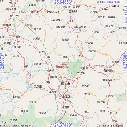
Huaping GPS coordinates[2]
25° 0' 46.836" North, 113° 34' 22.26" East
| Map corner | latitude | longitude |
|---|---|---|
| Upper-left | 25.64853°, | 112.86973° |
| Center: | 25.01301°, | 113.57285° |
| Lower-right: | 24.37419°, | 114.27598° |
| Map W x H: | 141.7×141.7 km | = 88×88mi |
| max Lat: | 53.31946° ⇑86.3% North |
| Huaping: | 25.01301° |
| min Lat: | ⇓13.7% South 18.22056° |
| min Long | Huaping | max Long |
| 75.07348° | 113.57285° | 134.28917° |
| W 46.1%⇐ | ⇒53.9% E |
Elevation
Elevation of Huaping is 382 m = 1253 ft, and this is 102.8 m = 337 ft below average elevation for this country.
| Max E: |
5622 m = 18445 ft | 31.7% |
| Avg. | 484.8 m = 1591 ft | |
| Huaping | 382 m = 1253 ft | |
Min E: |
-3 m = -10 ft | 68.3% |
See also: China elevation on elevation.city.
Geographical zone
Huaping is located in North temperate zone (between Tropic of Cancer and the Arctic Circle). Distance of this Northern Tropic circle is 175.3 km =108.9 mi to South.| Distance of | km | miles | from Huaping |
|---|---|---|---|
| North Pole | 7225.9 | 4490 | to North |
| Arctic Circle | 4620 | 2870.7 | to North |
| Tropic Cancer | 175.3 | 108.9 | to South |
| Equator | 2781.2 | 1728.2 | to South |


Nearby cities:
15 places around Huaping: (largest is in red/bold)
• Changlai
19.7 km =12.2 mi,  294°
294°
• Danxia
18.1 km =11.2 mi,  77°
77°
• Daqiao
21.6 km =13.4 mi,  121°
121°
• Dongtang
9.5 km =5.9 mi,  37°
37°
• Guitou
18.1 km =11.2 mi,  240°
240°
• Langtian
19.9 km =12.4 mi,  322°
322°
• Lishi
13.3 km =8.3 mi,  201°
201°
• Renhua
19.4 km =12.1 mi,  63°
63°
• Shaoguan
23.7 km =14.7 mi,  177°
177°
• Shiliting
18.4 km =11.4 mi, 182°
• Shitang
6.9 km =4.3 mi,  355°
355°
• Xihe
23.4 km =14.5 mi, 182°
• Xinshao
21.5 km =13.4 mi,  171°
171°
• Youxi
22.3 km =13.9 mi,  253°
253°
• Zhongyang
18.4 km =11.4 mi,  218°
218°
Sources, notices
• [Note1] Compared only with cities in China existing in our database
• [Src1] Map data: © OpenStreetMap contributors (CC-BY-SA)
• [Src2] Other city data from geonames.org with taken over terms of usage.
• [Src3] Geographical zone / Annual Mean Temperature by Robert A. Rohde @ Wikipedia
