Xi’ao geodata
Xi’ao (Chongqing) is a seat of a fourth-order administrative division; located in China in Asia/Shanghai (GMT+8) time zone. In our database, there are 1268 cities with bigger population. Compared to other cities in China, 70.4% of cities are located further ↑North; 84.4% of cities are located further ←West and 79.6% of cities have lower elevation than Xi’ao. Note1


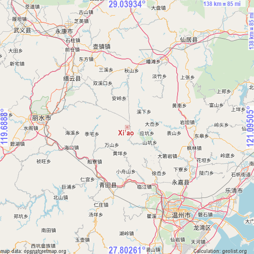
Xi’ao GPS coordinates[2]
28° 25' 22.008" North, 120° 23' 30.912" East
| Map corner | latitude | longitude |
|---|---|---|
| Upper-left | 29.03934°, | 119.6888° |
| Center: | 28.42278°, | 120.39192° |
| Lower-right: | 27.80261°, | 121.09505° |
| Map W x H: | 137.5×137.5 km | = 85.4×85.4mi |
| max Lat: | 53.31946° ⇑70.4% North |
| Xi’ao: | 28.42278° |
| min Lat: | ⇓29.6% South 18.22056° |
| min Long | Xi’ao | max Long |
| 75.07348° | 120.39192° | 134.28917° |
| W 84.4%⇐ | ⇒15.6% E |
Elevation
Elevation of Xi’ao is 678 m = 2224 ft, and this is 193.2 m = 634 ft above average elevation for this country.
| Max E: |
5622 m = 18445 ft | 20.4% |
| Xi’ao | 678 m 2224 ft | |
| Avg. | 484.8 m = 1591 ft | |
Min E: |
-3 m = -10 ft | 79.6% |
See also: China elevation on elevation.city.
Geographical zone
Xi’ao is located in North temperate zone (between Tropic of Cancer and the Arctic Circle). Distance of this Northern Tropic circle is 554.4 km =344.5 mi to South.| Distance of | km | miles | from Xi’ao |
|---|---|---|---|
| North Pole | 6846.7 | 4254.3 | to North |
| Arctic Circle | 4240.9 | 2635.2 | to North |
| Tropic Cancer | 554.4 | 344.5 | to South |
| Equator | 3160.3 | 1963.7 | to South |


Nearby cities:
15 places around Xi’ao: (largest is in red/bold)
• Anling
16.4 km =10.2 mi,  344°
344°
• Dayang
16.3 km =10.1 mi,  306°
306°
• Da’ao
13.7 km =8.5 mi,  82°
82°
• Huangyang
14.6 km =9.1 mi,  195°
195°
• Jiekeng
3 km =1.9 mi,  23°
23°
• Lizhai
19.3 km =12 mi,  259°
259°
• Muli
5.8 km =3.6 mi,  300°
300°
• Nanxi
11.5 km =7.1 mi, 314°
• Pankeng
19.2 km =11.9 mi, 79°
• Shankeng
14.8 km =9.2 mi,  123°
123°
• Shiran
8.2 km =5.1 mi,  168°
168°
• Wanshan
12.7 km =7.9 mi,  220°
220°
• Xixia
12.5 km =7.8 mi,  47°
47°
• Xunzhai
12.1 km =7.5 mi,  133°
133°
• Yingkeng
11.2 km =7 mi,  106°
106°
Sources, notices
• [Note1] Compared only with cities in China existing in our database
• [Src1] Map data: © OpenStreetMap contributors (CC-BY-SA)
• [Src2] Other city data from geonames.org with taken over terms of usage.
• [Src3] Geographical zone / Annual Mean Temperature by Robert A. Rohde @ Wikipedia
