Linqu geodata
Linqu (Shandong) is a populated place; located in China in Asia/Shanghai (GMT+8) time zone. With population of 77,472 people, there are 553 cities with bigger population in this country. Compared to other cities in China, 78.3% of cities are located further ↓South; 73.5% of cities are located further ←West and 60.3% of cities have higher elevation than Linqu. Note1


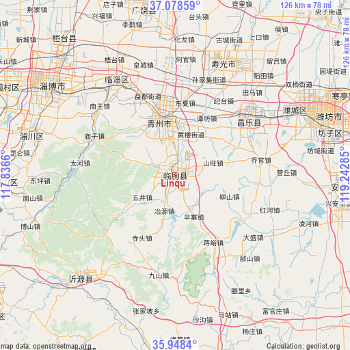
Linqu GPS coordinates[2]
36° 30' 56.016" North, 118° 32' 22.992" East
| Map corner | latitude | longitude |
|---|---|---|
| Upper-left | 37.07859°, | 117.8366° |
| Center: | 36.51556°, | 118.53972° |
| Lower-right: | 35.9484°, | 119.24285° |
| Map W x H: | 125.7×125.7 km | = 78.1×78.1mi |
| max Lat: | 53.31946° ⇑21.7% North |
| Linqu: | 36.51556° |
| min Lat: | ⇓78.3% South 18.22056° |
| min Long | Linqu | max Long |
| 75.07348° | 118.53972° | 134.28917° |
| W 73.5%⇐ | ⇒26.5% E |
Elevation
Elevation of Linqu is 97 m = 318 ft, and this is 387.8 m = 1272 ft below average elevation for this country.
| Max E: |
5622 m = 18445 ft | 60.3% |
| Avg. | 484.8 m = 1591 ft | |
| Linqu | 97 m = 318 ft | |
Min E: |
-3 m = -10 ft | 39.7% |
See also: Linqu elevation on elevation.city.
Geographical zone
Linqu is located in North temperate zone (between Tropic of Cancer and the Arctic Circle). Distance of this Northern Tropic circle is 1454.2 km =903.6 mi to South.| Distance of | km | miles | from Linqu |
|---|---|---|---|
| North Pole | 5946.9 | 3695.2 | to North |
| Arctic Circle | 3341 | 2076 | to North |
| Tropic Cancer | 1454.2 | 903.6 | to South |
| Equator | 4060.1 | 2522.8 | to South |


Nearby cities:
15 places around Linqu: (largest is in red/bold)
• Anqiu
59.1 km =36.7 mi,  98°
98°
• Boshan
63.2 km =39.3 mi,  266°
266°
• Dongping
48.6 km =30.2 mi, 267°
• Guangrao
61 km =37.9 mi,  348°
348°
• Hanting
66.3 km =41.2 mi,  64°
64°
• Nanding
50.3 km =31.3 mi,  300°
300°
• Nanma
50.4 km =31.3 mi,  223°
223°
• Qingzhou
20.8 km =12.9 mi, 345°
• Shouguang
44.2 km =27.5 mi,  23°
23°
• Suozhen
62.3 km =38.7 mi,  321°
321°
• Weifang
54.6 km =33.9 mi,  66°
66°
• Xindian
38.2 km =23.7 mi,  325°
325°
• Yangzi
80.4 km =50 mi,  42°
42°
• Zhoucun
72.7 km =45.2 mi, 297°
• Zibo
52.4 km =32.6 mi,  305°
305°
Sources, notices
• [Note1] Compared only with cities in China existing in our database
• [Src1] Map data: © OpenStreetMap contributors (CC-BY-SA)
• [Src2] Other city data from geonames.org with taken over terms of usage.
• [Src3] Geographical zone / Annual Mean Temperature by Robert A. Rohde @ Wikipedia
