Guangrao geodata
Guangrao (Shandong) is a seat of a third-order administrative division; located in China in Asia/Shanghai (GMT+8) time zone. In our database, there are 1268 cities with bigger population. Compared to other cities in China, 79.3% of cities are located further ↓South; 72.5% of cities are located further ←West and 84.9% of cities have higher elevation than Guangrao. Note1


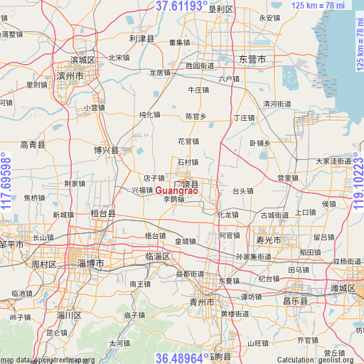
Guangrao GPS coordinates[2]
37° 3' 10.296" North, 118° 23' 56.76" East
| Map corner | latitude | longitude |
|---|---|---|
| Upper-left | 37.61193°, | 117.69598° |
| Center: | 37.05286°, | 118.3991° |
| Lower-right: | 36.48964°, | 119.10223° |
| Map W x H: | 124.8×124.8 km | = 77.5×77.5mi |
| max Lat: | 53.31946° ⇑20.7% North |
| Guangrao: | 37.05286° |
| min Lat: | ⇓79.3% South 18.22056° |
| min Long | Guangrao | max Long |
| 75.07348° | 118.3991° | 134.28917° |
| W 72.5%⇐ | ⇒27.5% E |
Elevation
Elevation of Guangrao is 16 m = 52 ft, and this is 468.8 m = 1538 ft below average elevation for this country.
| Max E: |
5622 m = 18445 ft | 84.9% |
| Avg. | 484.8 m = 1591 ft | |
| Guangrao | 16 m = 52 ft | |
Min E: |
-3 m = -10 ft | 15.1% |
See also: China elevation on elevation.city.
Geographical zone
Guangrao is located in North temperate zone (between Tropic of Cancer and the Arctic Circle). Distance of this Northern Tropic circle is 1514 km =940.8 mi to South.| Distance of | km | miles | from Guangrao |
|---|---|---|---|
| North Pole | 5887.2 | 3658.1 | to North |
| Arctic Circle | 3281.3 | 2038.9 | to North |
| Tropic Cancer | 1514 | 940.8 | to South |
| Equator | 4119.9 | 2560 | to South |


Nearby cities:
15 places around Guangrao: (largest is in red/bold)
• Binzhou
48.6 km =30.2 mi,  315°
315°
• Dongping
71.3 km =44.3 mi,  210°
210°
• Guangrao
23.7 km =14.7 mi,  13°
13°
• Hanting
78.7 km =48.9 mi,  113°
113°
• Linqu
61 km =37.9 mi,  168°
168°
• Nanding
45.6 km =28.3 mi,  222°
222°
• Qingzhou
40.2 km =25 mi, 169°
• Shengli
46.3 km =28.8 mi, 10°
• Shouguang
35.7 km =22.2 mi,  122°
122°
• Suozhen
28.4 km =17.6 mi,  247°
247°
• Weifang
73.2 km =45.5 mi, 121°
• Xindian
29.9 km =18.6 mi,  198°
198°
• Yangzi
67 km =41.6 mi,  90°
90°
• Zhoucun
58 km =36 mi,  243°
243°
• Zibo
41.7 km =25.9 mi,  225°
225°
Sources, notices
• [Note1] Compared only with cities in China existing in our database
• [Src1] Map data: © OpenStreetMap contributors (CC-BY-SA)
• [Src2] Other city data from geonames.org with taken over terms of usage.
• [Src3] Geographical zone / Annual Mean Temperature by Robert A. Rohde @ Wikipedia
