Liaoquan geodata
Liaoquan (Gansu) is a seat of a fourth-order administrative division; located in China in Asia/Shanghai (GMT+8) time zone. In our database, there are 1268 cities with bigger population. Compared to other cities in China, 84.2% of cities are located further ↓South; 94.5% of cities are located further →East and 90% of cities have lower elevation than Liaoquan. Note1


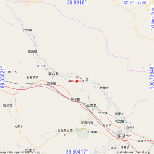
Liaoquan GPS coordinates[2]
39° 21' 0" North, 100° 1' 59.988" East
| Map corner | latitude | longitude |
|---|---|---|
| Upper-left | 39.8916°, | 99.33021° |
| Center: | 39.35°, | 100.03333° |
| Lower-right: | 38.80417°, | 100.73646° |
| Map W x H: | 120.9×120.9 km | = 75.1×75.1mi |
| max Lat: | 53.31946° ⇑15.8% North |
| Liaoquan: | 39.35° |
| min Lat: | ⇓84.2% South 18.22056° |
| min Long | Liaoquan | max Long |
| 75.07348° | 100.03333° | 134.28917° |
| W 5.5%⇐ | ⇒94.5% E |
Elevation
Elevation of Liaoquan is 1366 m = 4482 ft, and this is 881.2 m = 2891 ft above average elevation for this country.
| Max E: |
5622 m = 18445 ft | 10% |
| Liaoquan | 1366 m 4482 ft | |
| Avg. | 484.8 m = 1591 ft | |
Min E: |
-3 m = -10 ft | 90% |
See also: China elevation on elevation.city.
Geographical zone
Liaoquan is located in North temperate zone (between Tropic of Cancer and the Arctic Circle). Distance of this Northern Tropic circle is 1769.4 km =1099.5 mi to South.| Distance of | km | miles | from Liaoquan |
|---|---|---|---|
| North Pole | 5631.8 | 3499.4 | to North |
| Arctic Circle | 3025.9 | 1880.2 | to North |
| Tropic Cancer | 1769.4 | 1099.5 | to South |
| Equator | 4375.3 | 2718.7 | to South |


Nearby cities:
15 places around Liaoquan: (largest is in red/bold)
• Baiyin
49.6 km =30.8 mi,  194°
194°
• Banqiao
25 km =15.5 mi,  104°
104°
• Ganjun
44.3 km =27.5 mi,  164°
164°
• Gaotai Chengguanzhen
20.1 km =12.5 mi,  268°
268°
• Heiquan
40.3 km =25 mi,  297°
297°
• Jing’an
42.5 km =26.4 mi,  130°
130°
• Luocheng
55.3 km =34.4 mi,  312°
312°
• Minghai
55.5 km =34.5 mi,  287°
287°
• Nanhua
21.8 km =13.5 mi,  260°
260°
• Nanjie
58 km =36 mi,  139°
139°
• Sanzha
55.3 km =34.4 mi, 134°
• Shahe
26.3 km =16.3 mi,  151°
151°
• Shajing
34.3 km =21.3 mi, 144°
• Wujiang
52.6 km =32.7 mi, 134°
• Xinhua
16.9 km =10.5 mi, 189°
Sources, notices
• [Note1] Compared only with cities in China existing in our database
• [Src1] Map data: © OpenStreetMap contributors (CC-BY-SA)
• [Src2] Other city data from geonames.org with taken over terms of usage.
• [Src3] Geographical zone / Annual Mean Temperature by Robert A. Rohde @ Wikipedia
