Heiquan geodata
Heiquan (Gansu) is a seat of a fourth-order administrative division; located in China in Asia/Shanghai (GMT+8) time zone. In our database, there are 1268 cities with bigger population. Compared to other cities in China, 84.7% of cities are located further ↓South; 94.8% of cities are located further →East and 89.6% of cities have lower elevation than Heiquan. Note1


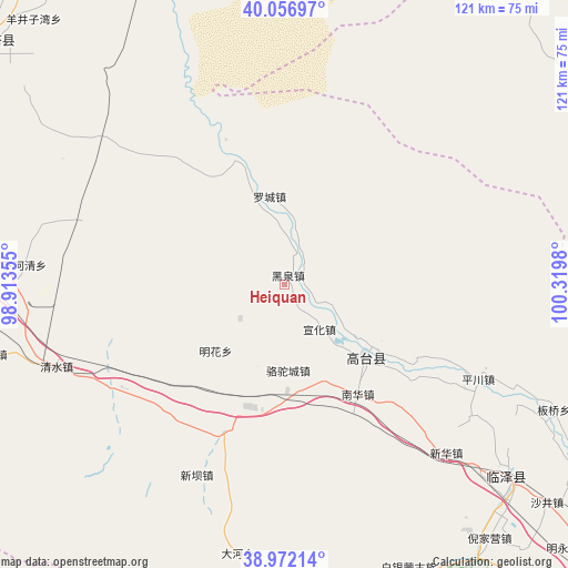
Heiquan GPS coordinates[2]
39° 31' 0.012" North, 99° 37' 0.012" East
| Map corner | latitude | longitude |
|---|---|---|
| Upper-left | 40.05697°, | 98.91355° |
| Center: | 39.51667°, | 99.61667° |
| Lower-right: | 38.97214°, | 100.3198° |
| Map W x H: | 120.6×120.6 km | = 74.9×74.9mi |
| max Lat: | 53.31946° ⇑15.3% North |
| Heiquan: | 39.51667° |
| min Lat: | ⇓84.7% South 18.22056° |
| min Long | Heiquan | max Long |
| 75.07348° | 99.61667° | 134.28917° |
| W 5.2%⇐ | ⇒94.8% E |
Elevation
Elevation of Heiquan is 1327 m = 4354 ft, and this is 842.2 m = 2763 ft above average elevation for this country.
| Max E: |
5622 m = 18445 ft | 10.4% |
| Heiquan | 1327 m 4354 ft | |
| Avg. | 484.8 m = 1591 ft | |
Min E: |
-3 m = -10 ft | 89.6% |
See also: China elevation on elevation.city.
Geographical zone
Heiquan is located in North temperate zone (between Tropic of Cancer and the Arctic Circle). Distance of this Northern Tropic circle is 1787.9 km =1110.9 mi to South.| Distance of | km | miles | from Heiquan |
|---|---|---|---|
| North Pole | 5613.2 | 3487.9 | to North |
| Arctic Circle | 3007.3 | 1868.6 | to North |
| Tropic Cancer | 1787.9 | 1110.9 | to South |
| Equator | 4393.8 | 2730.2 | to South |


Nearby cities:
15 places around Heiquan: (largest is in red/bold)
• Baiyin
70.5 km =43.8 mi,  160°
160°
• Banqiao
64.9 km =40.3 mi,  112°
112°
• Gaotai Chengguanzhen
24.8 km =15.4 mi,  140°
140°
• Hongyazi
48.6 km =30.2 mi,  213°
213°
• Jinfosi
69.9 km =43.4 mi,  259°
259°
• Lianhua
46.1 km =28.6 mi,  286°
286°
• Liaoquan
40.3 km =25 mi,  117°
117°
• Luocheng
19.2 km =11.9 mi,  343°
343°
• Minghai
17.3 km =10.7 mi, 263°
• Nanhua
26.4 km =16.4 mi,  147°
147°
• Qingshui
44.1 km =27.4 mi,  250°
250°
• Shahe
63.8 km =39.6 mi,  130°
130°
• Xiaheqing
56 km =34.8 mi,  275°
275°
• Xinba
43.8 km =27.2 mi,  204°
204°
• Xinhua
48.2 km =30 mi, 136°
Sources, notices
• [Note1] Compared only with cities in China existing in our database
• [Src1] Map data: © OpenStreetMap contributors (CC-BY-SA)
• [Src2] Other city data from geonames.org with taken over terms of usage.
• [Src3] Geographical zone / Annual Mean Temperature by Robert A. Rohde @ Wikipedia
