Konglong geodata
Konglong (Hubei) is a seat of a fourth-order administrative division; located in China in Asia/Shanghai (GMT+8) time zone. In our database, there are 1268 cities with bigger population. Compared to other cities in China, 55.3% of cities are located further ↑North; 59.5% of cities are located further ←West and 83.4% of cities have higher elevation than Konglong. Note1


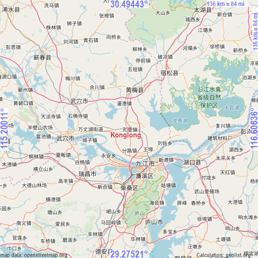
Konglong GPS coordinates[2]
29° 53' 12.048" North, 115° 54' 11.628" East
| Map corner | latitude | longitude |
|---|---|---|
| Upper-left | 30.49443°, | 115.20011° |
| Center: | 29.88668°, | 115.90323° |
| Lower-right: | 29.27521°, | 116.60636° |
| Map W x H: | 135.6×135.6 km | = 84.3×84.3mi |
| max Lat: | 53.31946° ⇑55.3% North |
| Konglong: | 29.88668° |
| min Lat: | ⇓44.7% South 18.22056° |
| min Long | Konglong | max Long |
| 75.07348° | 115.90323° | 134.28917° |
| W 59.5%⇐ | ⇒40.5% E |
Elevation
Elevation of Konglong is 19 m = 62 ft, and this is 465.8 m = 1528 ft below average elevation for this country.
| Max E: |
5622 m = 18445 ft | 83.4% |
| Avg. | 484.8 m = 1591 ft | |
| Konglong | 19 m = 62 ft | |
Min E: |
-3 m = -10 ft | 16.6% |
See also: China elevation on elevation.city.
Geographical zone
Konglong is located in North temperate zone (between Tropic of Cancer and the Arctic Circle). Distance of this Northern Tropic circle is 717.2 km =445.6 mi to South.| Distance of | km | miles | from Konglong |
|---|---|---|---|
| North Pole | 6684 | 4153.2 | to North |
| Arctic Circle | 4078.1 | 2534 | to North |
| Tropic Cancer | 717.2 | 445.6 | to South |
| Equator | 3323.1 | 2064.9 | to South |


Nearby cities:
15 places around Konglong: (largest is in red/bold)
• Caishan
11.2 km =7 mi,  268°
268°
• Chengzi
21.4 km =13.3 mi,  255°
255°
• Fenlu
10.9 km =6.8 mi,  180°
180°
• Gangkoujie
21.4 km =13.3 mi,  213°
213°
• Huangmei
21.7 km =13.5 mi,  9°
9°
• Huaqiao
22.8 km =14.2 mi,  308°
308°
• Jiujiang
22.4 km =13.9 mi,  154°
154°
• Liuzuo
20 km =12.4 mi,  110°
110°
• Longping
19.9 km =12.4 mi, 264°
• Xiaochi
17 km =10.6 mi, 150°
• Xiaxin
15.2 km =9.4 mi,  41°
41°
• Xinkai
12.2 km =7.6 mi,  227°
227°
• Yong’an
17.4 km =10.8 mi,  219°
219°
• Zhanghekou
19.1 km =11.9 mi, 309°
• Zhuogang
14.2 km =8.8 mi,  349°
349°
Sources, notices
• [Note1] Compared only with cities in China existing in our database
• [Src1] Map data: © OpenStreetMap contributors (CC-BY-SA)
• [Src2] Other city data from geonames.org with taken over terms of usage.
• [Src3] Geographical zone / Annual Mean Temperature by Robert A. Rohde @ Wikipedia
