Huangqiao geodata
Huangqiao (Hunan) is a populated place; located in China in Asia/Shanghai (GMT+8) time zone. With population of 2,600 people, there are 977 cities with bigger population in this country. Compared to other cities in China, 78.5% of cities are located further ↑North; 67.7% of cities are located further →East and 60.4% of cities have lower elevation than Huangqiao. Note1


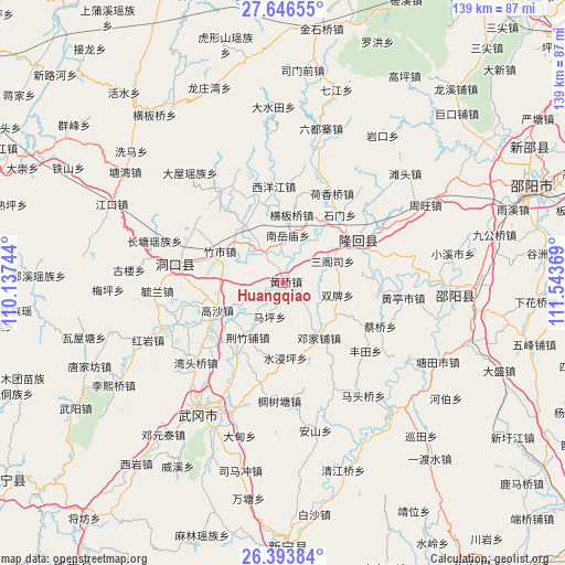
Huangqiao GPS coordinates[2]
27° 1' 18.984" North, 110° 50' 26.016" East
| Map corner | latitude | longitude |
|---|---|---|
| Upper-left | 27.64655°, | 110.13744° |
| Center: | 27.02194°, | 110.84056° |
| Lower-right: | 26.39384°, | 111.54369° |
| Map W x H: | 139.3×139.3 km | = 86.6×86.6mi |
| max Lat: | 53.31946° ⇑78.5% North |
| Huangqiao: | 27.02194° |
| min Lat: | ⇓21.5% South 18.22056° |
| min Long | Huangqiao | max Long |
| 75.07348° | 110.84056° | 134.28917° |
| W 32.3%⇐ | ⇒67.7% E |
Elevation
Elevation of Huangqiao is 265 m = 869 ft, and this is 219.8 m = 721 ft below average elevation for this country.
| Max E: |
5622 m = 18445 ft | 39.6% |
| Avg. | 484.8 m = 1591 ft | |
| Huangqiao | 265 m = 869 ft | |
Min E: |
-3 m = -10 ft | 60.4% |
See also: China elevation on elevation.city.
Geographical zone
Huangqiao is located in North temperate zone (between Tropic of Cancer and the Arctic Circle). Distance of this Northern Tropic circle is 398.6 km =247.7 mi to South.| Distance of | km | miles | from Huangqiao |
|---|---|---|---|
| North Pole | 7002.5 | 4351.2 | to North |
| Arctic Circle | 4396.6 | 2731.9 | to North |
| Tropic Cancer | 398.6 | 247.7 | to South |
| Equator | 3004.6 | 1867 | to South |


Nearby cities:
15 places around Huangqiao: (largest is in red/bold)
• Beishan
25.4 km =15.8 mi,  74°
74°
• Dengjiapu
15.3 km =9.5 mi,  148°
148°
• Hengbanqiao
16.8 km =10.4 mi,  8°
8°
• Hexiangqiao
25.2 km =15.7 mi,  28°
28°
• Ma’an
12.8 km =8 mi,  247°
247°
• Nanyuemiao
11.8 km =7.3 mi, 5°
• Sangesi
12.3 km =7.6 mi, 66°
• Shanjie
18.8 km =11.7 mi, 70°
• Shanmen
26.9 km =16.7 mi,  327°
327°
• Shijiang
8.1 km =5 mi,  324°
324°
• Shimen
29.5 km =18.3 mi,  39°
39°
• Taohong
17.6 km =10.9 mi,  60°
60°
• Wantouqiao
29.7 km =18.5 mi,  227°
227°
• Xiyangjiang
18.8 km =11.7 mi,  356°
356°
• Zhushi
17.8 km =11.1 mi,  294°
294°
Sources, notices
• [Note1] Compared only with cities in China existing in our database
• [Src1] Map data: © OpenStreetMap contributors (CC-BY-SA)
• [Src2] Other city data from geonames.org with taken over terms of usage.
• [Src3] Geographical zone / Annual Mean Temperature by Robert A. Rohde @ Wikipedia
