Xiyangjiang geodata
Xiyangjiang (Hunan) is a seat of a fourth-order administrative division; located in China in Asia/Shanghai (GMT+8) time zone. In our database, there are 1268 cities with bigger population. Compared to other cities in China, 77.8% of cities are located further ↑North; 67.8% of cities are located further →East and 63.8% of cities have lower elevation than Xiyangjiang. Note1


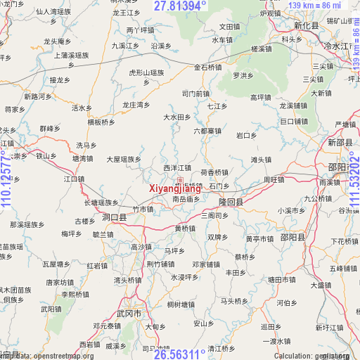
Xiyangjiang GPS coordinates[2]
27° 11' 25.008" North, 110° 49' 44.004" East
| Map corner | latitude | longitude |
|---|---|---|
| Upper-left | 27.81394°, | 110.12577° |
| Center: | 27.19028°, | 110.82889° |
| Lower-right: | 26.56311°, | 111.53202° |
| Map W x H: | 139.1×139.1 km | = 86.4×86.4mi |
| max Lat: | 53.31946° ⇑77.8% North |
| Xiyangjiang: | 27.19028° |
| min Lat: | ⇓22.2% South 18.22056° |
| min Long | Xiyangjiang | max Long |
| 75.07348° | 110.82889° | 134.28917° |
| W 32.2%⇐ | ⇒67.8% E |
Elevation
Elevation of Xiyangjiang is 308 m = 1010 ft, and this is 176.8 m = 580 ft below average elevation for this country.
| Max E: |
5622 m = 18445 ft | 36.2% |
| Avg. | 484.8 m = 1591 ft | |
| Xiyangjiang | 308 m = 1010 ft | |
Min E: |
-3 m = -10 ft | 63.8% |
See also: China elevation on elevation.city.
Geographical zone
Xiyangjiang is located in North temperate zone (between Tropic of Cancer and the Arctic Circle). Distance of this Northern Tropic circle is 417.4 km =259.4 mi to South.| Distance of | km | miles | from Xiyangjiang |
|---|---|---|---|
| North Pole | 6983.8 | 4339.5 | to North |
| Arctic Circle | 4377.9 | 2720.3 | to North |
| Tropic Cancer | 417.4 | 259.4 | to South |
| Equator | 3023.3 | 1878.6 | to South |


Nearby cities:
15 places around Xiyangjiang: (largest is in red/bold)
• Dashuitian
24.8 km =15.4 mi,  356°
356°
• Hengbanqiao
4.2 km =2.6 mi,  119°
119°
• Hetian
22.4 km =13.9 mi,  39°
39°
• Hexiangqiao
13.7 km =8.5 mi,  75°
75°
• Huangqiao
18.8 km =11.7 mi,  176°
176°
• Liuduzhai
22.2 km =13.8 mi,  28°
28°
• Matangshan
25.8 km =16 mi,  328°
328°
• Nanyuemiao
7.4 km =4.6 mi,  161°
161°
• Sangesi
18.5 km =11.5 mi,  137°
137°
• Shanjie
22.6 km =14 mi, 123°
• Shanmen
14 km =8.7 mi,  286°
286°
• Shijiang
12.5 km =7.8 mi,  196°
196°
• Shimen
20.3 km =12.6 mi, 78°
• Taohong
19.2 km =11.9 mi, 121°
• Zhushi
18.9 km =11.7 mi,  232°
232°
Sources, notices
• [Note1] Compared only with cities in China existing in our database
• [Src1] Map data: © OpenStreetMap contributors (CC-BY-SA)
• [Src2] Other city data from geonames.org with taken over terms of usage.
• [Src3] Geographical zone / Annual Mean Temperature by Robert A. Rohde @ Wikipedia
