Huangnan geodata
Huangnan (Zhejiang) is a seat of a fourth-order administrative division; located in China in Asia/Shanghai (GMT+8) time zone. In our database, there are 1268 cities with bigger population. Compared to other cities in China, 69.5% of cities are located further ↑North; 86.1% of cities are located further ←West and 50.2% of cities have lower elevation than Huangnan. Note1


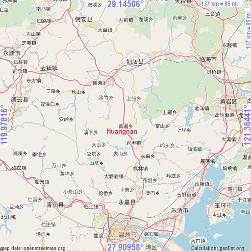
Huangnan GPS coordinates[2]
28° 31' 44.868" North, 120° 40' 52.608" East
| Map corner | latitude | longitude |
|---|---|---|
| Upper-left | 29.14506°, | 119.97816° |
| Center: | 28.52913°, | 120.68128° |
| Lower-right: | 27.90958°, | 121.38441° |
| Map W x H: | 137.4×137.4 km | = 85.4×85.4mi |
| max Lat: | 53.31946° ⇑69.5% North |
| Huangnan: | 28.52913° |
| min Lat: | ⇓30.5% South 18.22056° |
| min Long | Huangnan | max Long |
| 75.07348° | 120.68128° | 134.28917° |
| W 86.1%⇐ | ⇒13.9% E |
Elevation
Elevation of Huangnan is 167 m = 548 ft, and this is 317.8 m = 1043 ft below average elevation for this country.
| Max E: |
5622 m = 18445 ft | 49.8% |
| Avg. | 484.8 m = 1591 ft | |
| Huangnan | 167 m = 548 ft | |
Min E: |
-3 m = -10 ft | 50.2% |
See also: China elevation on elevation.city.
Geographical zone
Huangnan is located in North temperate zone (between Tropic of Cancer and the Arctic Circle). Distance of this Northern Tropic circle is 566.2 km =351.8 mi to South.| Distance of | km | miles | from Huangnan |
|---|---|---|---|
| North Pole | 6834.9 | 4247 | to North |
| Arctic Circle | 4229 | 2627.8 | to North |
| Tropic Cancer | 566.2 | 351.8 | to South |
| Equator | 3172.1 | 1971.1 | to South |


Nearby cities:
15 places around Huangnan: (largest is in red/bold)
• Biaoshan
15.2 km =9.4 mi,  190°
190°
• Danzhu
19.3 km =12 mi,  326°
326°
• Da’ao
17.8 km =11.1 mi,  235°
235°
• Donggao
20.4 km =12.7 mi,  143°
143°
• Fushan
20 km =12.4 mi,  89°
89°
• Hesheng
22.7 km =14.1 mi, 138°
• Lixi
15.9 km =9.9 mi,  145°
145°
• Pankeng
12.6 km =7.8 mi,  227°
227°
• Shangzhang
15.9 km =9.9 mi,  15°
15°
• Xikou
11.3 km =7 mi,  161°
161°
• Xixia
19.4 km =12.1 mi,  260°
260°
• Xiyuan
19.9 km =12.4 mi,  129°
129°
• Yantan
10 km =6.2 mi, 154°
• Yantou
21.4 km =13.3 mi,  167°
167°
• Zhangxi
10.6 km =6.6 mi,  119°
119°
Sources, notices
• [Note1] Compared only with cities in China existing in our database
• [Src1] Map data: © OpenStreetMap contributors (CC-BY-SA)
• [Src2] Other city data from geonames.org with taken over terms of usage.
• [Src3] Geographical zone / Annual Mean Temperature by Robert A. Rohde @ Wikipedia
