Baiyangping geodata
Baiyangping (Hubei) is a seat of a fourth-order administrative division; located in China in Asia/Shanghai (GMT+8) time zone. In our database, there are 1268 cities with bigger population. Compared to other cities in China, 50.3% of cities are located further ↓South; 73.1% of cities are located further →East and 80.3% of cities have lower elevation than Baiyangping. Note1


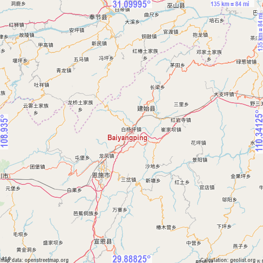
Baiyangping GPS coordinates[2]
30° 29' 45.564" North, 109° 38' 17.232" East
| Map corner | latitude | longitude |
|---|---|---|
| Upper-left | 31.09995°, | 108.935° |
| Center: | 30.49599°, | 109.63812° |
| Lower-right: | 29.88825°, | 110.34125° |
| Map W x H: | 134.7×134.7 km | = 83.7×83.7mi |
| max Lat: | 53.31946° ⇑49.7% North |
| Baiyangping: | 30.49599° |
| min Lat: | ⇓50.3% South 18.22056° |
| min Long | Baiyangping | max Long |
| 75.07348° | 109.63812° | 134.28917° |
| W 26.9%⇐ | ⇒73.1% E |
Elevation
Elevation of Baiyangping is 711 m = 2333 ft, and this is 226.2 m = 742 ft above average elevation for this country.
| Max E: |
5622 m = 18445 ft | 19.7% |
| Baiyangping | 711 m 2333 ft | |
| Avg. | 484.8 m = 1591 ft | |
Min E: |
-3 m = -10 ft | 80.3% |
See also: China elevation on elevation.city.
Geographical zone
Baiyangping is located in North temperate zone (between Tropic of Cancer and the Arctic Circle). Distance of this Northern Tropic circle is 784.9 km =487.7 mi to South.| Distance of | km | miles | from Baiyangping |
|---|---|---|---|
| North Pole | 6616.2 | 4111.1 | to North |
| Arctic Circle | 4010.3 | 2491.9 | to North |
| Tropic Cancer | 784.9 | 487.7 | to South |
| Equator | 3390.8 | 2106.9 | to South |


Nearby cities:
15 places around Baiyangping: (largest is in red/bold)
• Changliang
26.5 km =16.5 mi,  30°
30°
• Cuijiaba
20.3 km =12.6 mi,  86°
86°
• Enshi
26.4 km =16.4 mi,  214°
214°
• Heshuiping
22.5 km =14 mi,  65°
65°
• Hongyansi
26 km =16.2 mi,  76°
76°
• Longfengba
17.4 km =10.8 mi,  226°
226°
• Nuoxizhi
24.2 km =15 mi,  182°
182°
• Sancha
24.5 km =15.2 mi, 183°
• Shadi
20.7 km =12.9 mi,  148°
148°
• Taiyanghe
16.5 km =10.3 mi,  313°
313°
• Wuyangba
28.5 km =17.7 mi, 210°
• Xiaoduchuan
27.6 km =17.1 mi, 214°
• Xinglong
25.7 km =16 mi, 314°
• Xintang
27 km =16.8 mi,  156°
156°
• Yezhou
14.5 km =9 mi, 34°
Sources, notices
• [Note1] Compared only with cities in China existing in our database
• [Src1] Map data: © OpenStreetMap contributors (CC-BY-SA)
• [Src2] Other city data from geonames.org with taken over terms of usage.
• [Src3] Geographical zone / Annual Mean Temperature by Robert A. Rohde @ Wikipedia
